
Summer Series for the Weekend of June 18-20
BBBZZZZZZZZZZZZZZZZZZZZZ
BZZZZZZZZZZZZZZZZZZZZZZZZZZZZZZZ
BZZZZZZZZZZZZZZZZZZZZZZ
BBBZZZZZZZZZZZZZZZZZZZZZZZZ
O hi. Sorryz. Let me put my vuvuzela away. That’s better. On to the weather for the weekend.
| Jump to: | Synopsis | Friday | Saturday | Sunday | Extended |
SYNOPSIS:
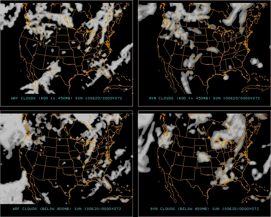
For the first time in a few weeks I can confidently say that there will be two consecutive nice days! As a we speak, a systems is slowly dragging a cool front and precip across the north country. Sat. imagery shows this pretty clearly as does the radar. South of Albany and east into Mass the front has cleared the area. Behind the system a High pressure system is moving in from the Ohio river valley, putting the flow from the NW. Thus bright sunny skies with warm temps and low humidity are the norm.
Turing the page to tomorrow and the weekend, the high will slide to the east over the next 18 hours. This sets up a return flow from the SE. Warming temps, increasing humidity and summer like back sweat will rule the roost from late Friday into Sat night. A weak front will push down from the NW on Sat. Some large storms could pop over extreme western NY and PA late Saturday but by the time the front enters our zones of concern the instability numbers should be pretty weak and nothing much looks to materialize.
By Sunday am, the front will be pushing out through NH/ME. Most will wake up to lingering broken clouds and a few showers (in the north country mainly). However at this time the showers look really weak and as the day goes on the sun and broken clouds, along with lower humidity and temps in the 70s should make Sunday another solid day.
| Jump to: | Synopsis | Friday | Saturday | Sunday | Extended |
FRIDAY:
Friday is going to be a good day. Like really good. Like why are you working inside good.
Primary Concerns: Sunburn. Seriously…it’s going to be a clear day near the strongest period for sun in the NE. Many of you (looking you G…I’ve seen the pictures) don’t have a base built up. Put the sun block on and thank me later.
Also, the bug level might start to get into the “wear bug spray levels.” I’ve read mixed reports about Black Fly activity. So maybe some all natural Buzz Away would be a good choice. It’s Ms. Hutz approved and that means something. She has sensitive skin, and hates bugs in her “grill.” (True story- she once dislocated her shoulder swatting a bug. Of course an hour later we played a full 18. She’s a trooper) So if it passes her test I’m sure it will pass yours.
Best Location: Outside.
Best Activity: Not working in an office.
Recreational Forecast:
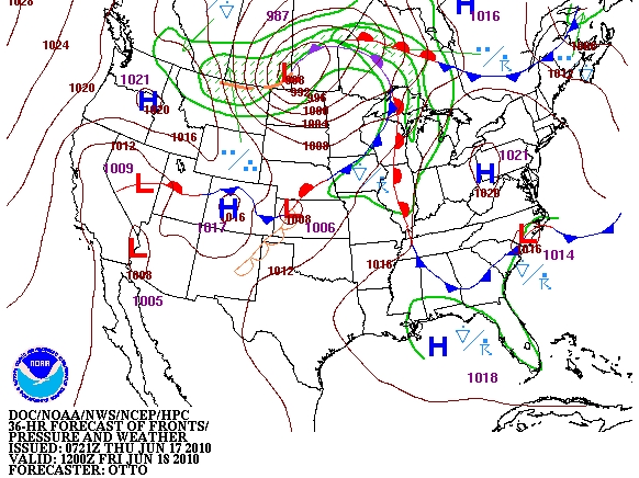
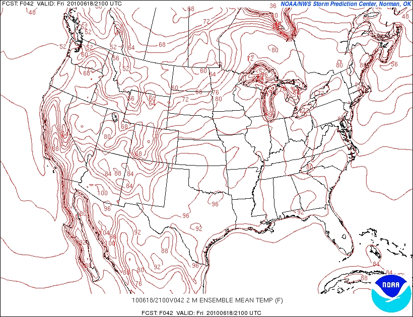
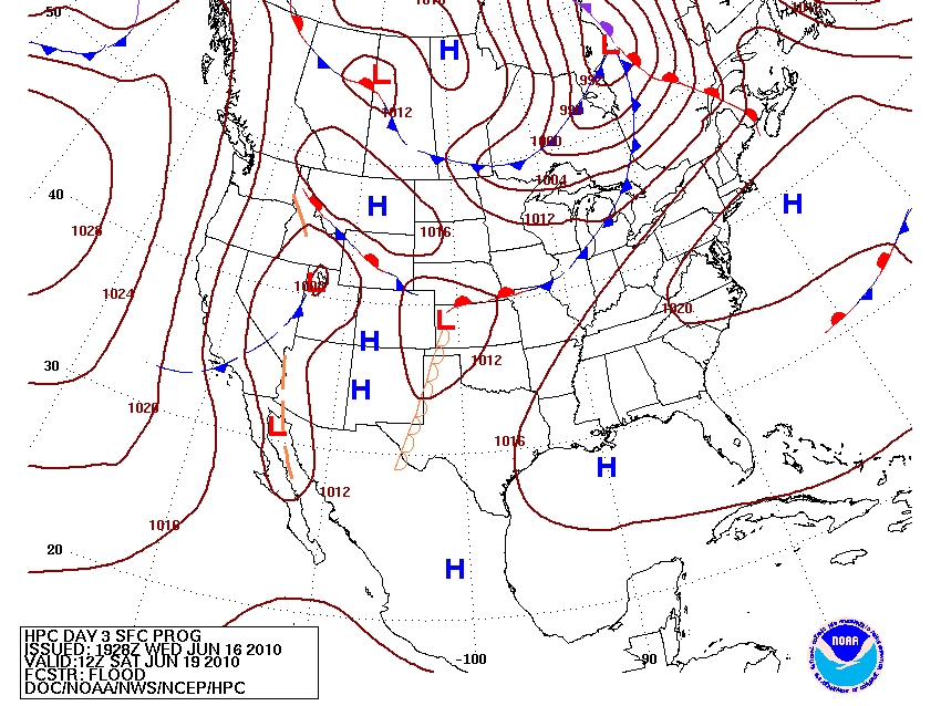
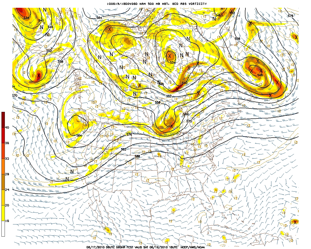
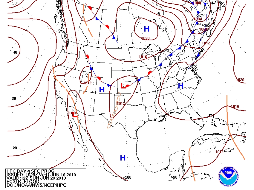
By early Friday morning, a departing system and associated cold front will have cleared the Northeast. In its wake, a strong high pressure system will move in from the Ohio river valley. HPC has a pretty good grasp on the placements that I agree with so look at it below.
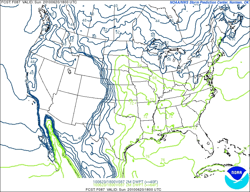
Since the center of high pressure will be to our SW for much of the day, the prevailing flow around the H will bring air from the NW. This will result in pretty low dewpoints.
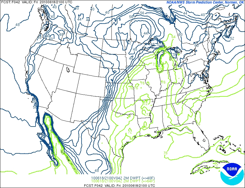
You can also clearly see the prevailing flow here:
What you can also see is the building ridge across the NE which will become an important player on Saturday.
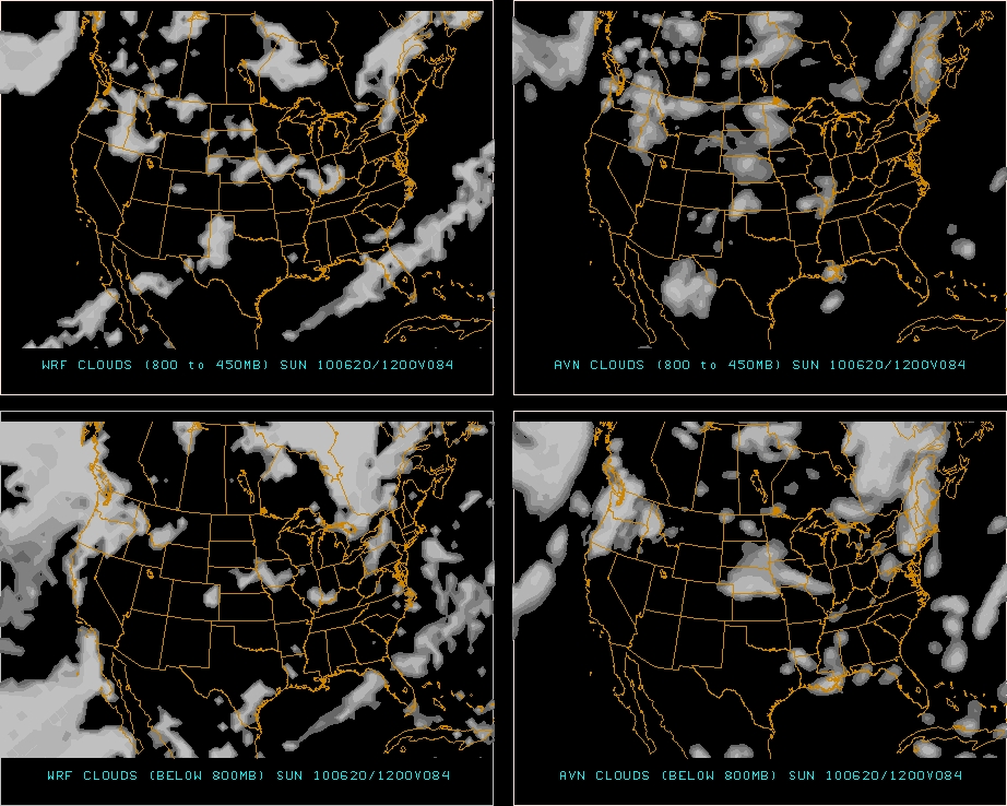
Importantly, skies will be very clear and the sun will shine. 
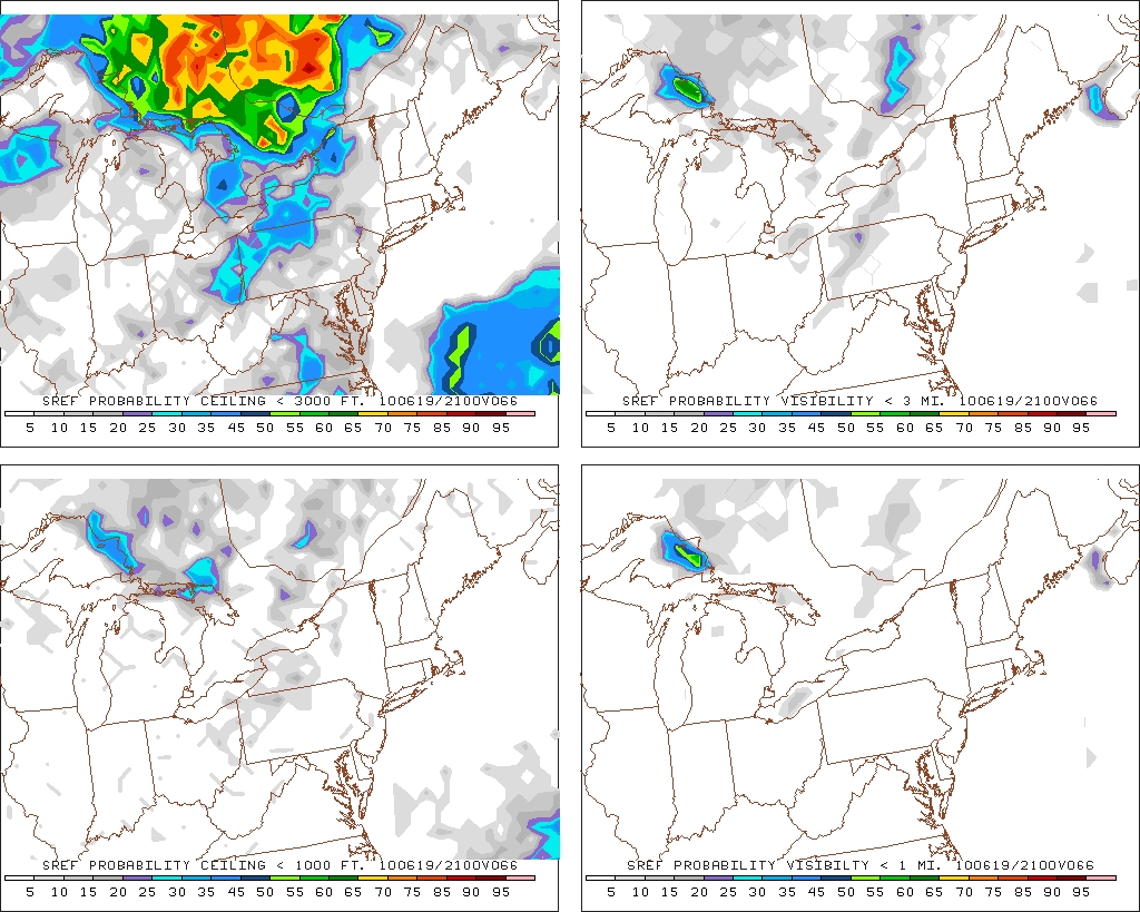
In fact, the overly cautious SREF probability models aren’t even giving the North Country a 5% chance of moderate height clouds.
That’s rare this time of year and awesome. The combination of clear skies and NW flow will keep temps in the very comfortable range. Temps between 72 and 78 should be pretty common.
So get out there tomorrow if you can.
| Jump to: | Synopsis | Friday | Saturday | Sunday | Extended |
SATURDAY:
After a gem (no, not that kind of jem or that kind) of a day on Friday, Saturday will not dissapoint. With a return flow around the High pressure, plentiful sun, and warm temps, Saturday will be another great day in the North Country- albeit a bit sweatier.
Primary Concern: There are two. First the heat will be little more noticeable and with dew points moving into the 60s it could get a bit sticky in the afternoon. Nothing extreme but worth taking into account. Maybe you want to get that 100 mile bike ride done in the morning.
Second, a weak front will push in from the west towards the late afternoon. Out in western NY and PA this should set off some legit t-storms. However, given the timing right now, I think once the front reaches the central portions of the state the instability will crash. Maybe by 10pm or so a few stray weak t-storms or showers will start to move across the Catskills but that’s it really.
Best Areas: Again…every. If you really want to beat the heat head north.
Best Activity: Can’t think of a bad one. So long as you stay hydrated you can pretty much do anything.
RECREATIONAL FORECAST:
By Saturday morning, the high pressure center will have drifted east enough to turn the prevailing flow to a SW orientation.
This “return” flow will act to push warmer and humid air in to the region.
Dew points will accordingly rise in response. By the afternoon, PA, western NY, NJ and parts of SE NY will feel a little sticky.
At the same time, the skies will remain overwhelmingly clear.
Only by later in the afternoon does the chance for clouds begin to increase. And even then they remain in the very low probability realm.
The sun and return flow should push temps into the lower 80s across much of the region.
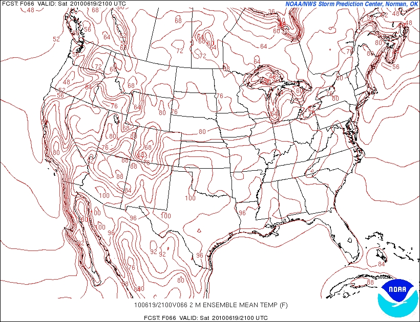
Notably, in the BTV and a few other valleys, there could be isolated pockets of upper 80s. That can feel pretty hot if the sun is beating down on you. So take a break, bring a hat and drink some water.
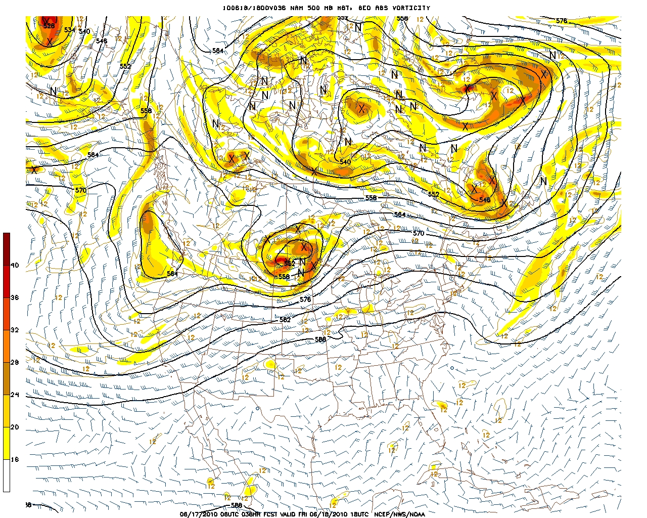
Now, as we enter the afternoon, a weak front will move in from the west associated with a robust upper level disturbance moving NNE through the Canadian great lakes.
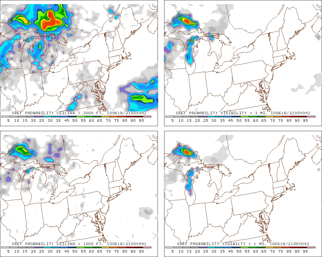
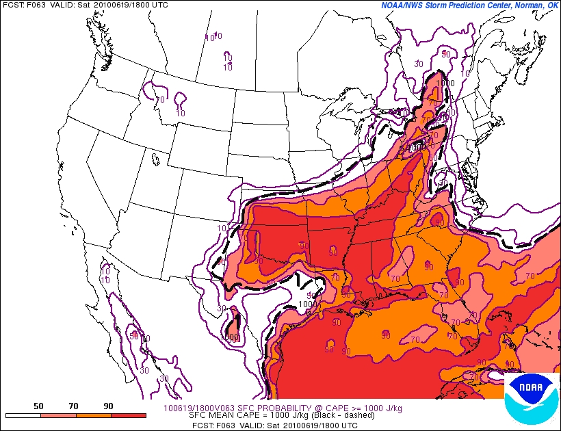
Looking at the instability numbers ahead of this front Sat. afternoon point to some thunderstorms across the far western part of the region.
CAPE:
| Jump to: | Synopsis | Friday | Saturday | Sunday | Extended |
 Lifted Index:
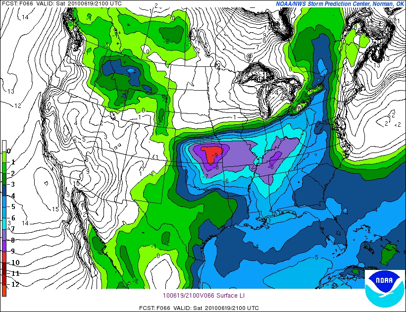 However, what you should notice is the sharp cutoff as you move to the east. Simply put the instability isn't there once you reach the catskills to support much T-storm growth. Plus right now the timing doesn't help. By the time the front reaches the catskills and ADK the primary heating of the day will be over and the upward motion from the surface heating will be on the decrease. This should kill our chances for an evening boomer. However, sometimes you got an outlier so just keep an ear to the sky.
SUNDAY:
Sunday, while not as awesome as Friday and Saturday will nevertheless be pretty nice. The cold front from Saturday should have pushed clear of most of the area by the morning. Behind the front, the NW flow will result in cool temps, low humidity and refreshing conditions.
Primary Concern: Lingering clouds and a weak shower in the north country. Afternoon T-storms in a narrow band from NYC through Conn, Mass and So. NH.
Best Areas: NY, VT, NW NH.
RECREATIONAL FORECAST:
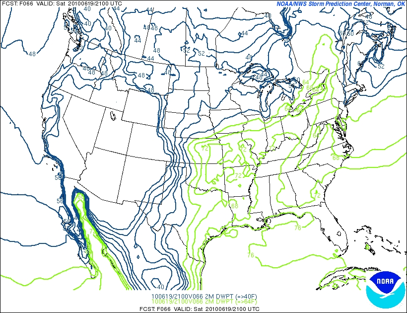
By Sunday am the front will have pushed east into eastern Mass, Conn. and NH.
Again, the resulting NW flow will bring dew points down quite a bit.
With cooler temps that only reach into the low to mid 70s.

Sunday should feel very comfortable.
Cloud cover should be fairly broken throughout the day. The heaviest will be in the morning however.
Given the cloud cover and some pockets of upward motion + the propensity of the Greens and ADK to surprise us with post frontal showers I’d keep a watch out for a stray sprinkle on sunday – esp. in the morning.
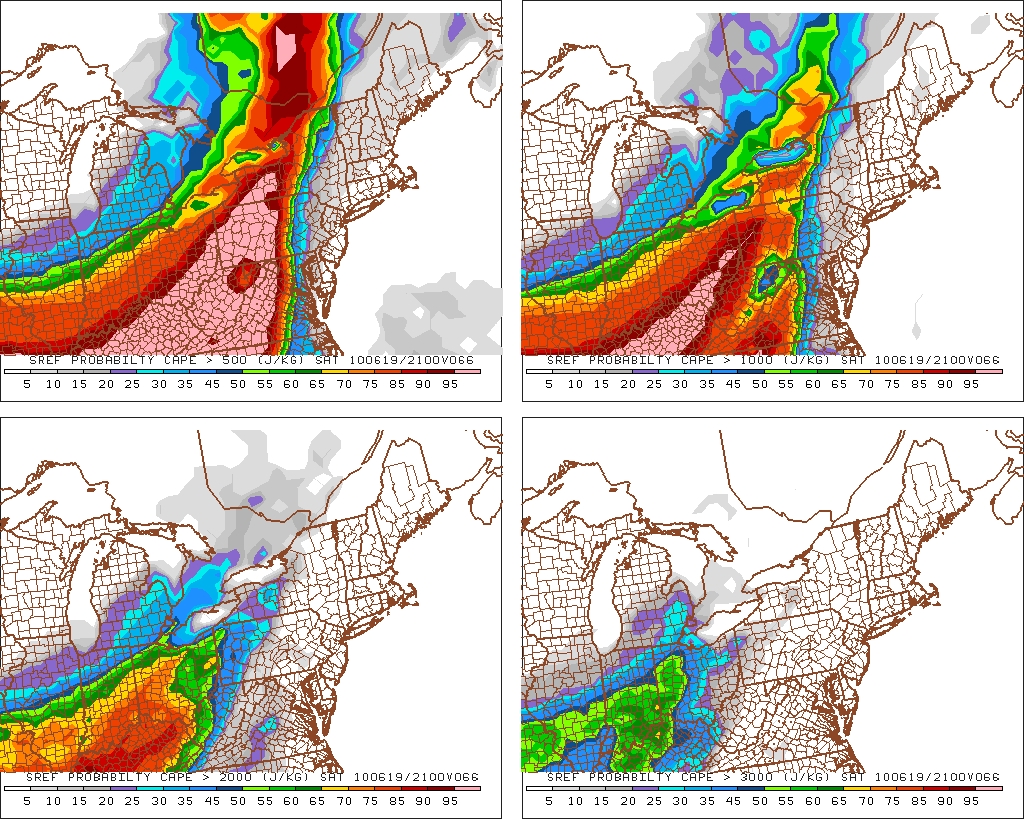
One other note- The front will raise the chance for T-storms in a narrow band. The SREF’s have some elevated CAPE values in this band:
Now this isn’t that significant right now but it’s something to watch as we head through the period.
| Jump to: | Synopsis | Friday | Saturday | Sunday | Extended |
Extended outlook
Monday looks to be nice with seasonable temps and mostly sunny conditions. A little warm south in the PA/NJ region but that’s summer!
Tuesday is much of the same with some very light moisture working through the North Country.

7 Comments
|
|||
| Home |

-
Search
New Comments
macbook repair seattle said: “macbook repair seattle Let’s get it started...(read more)” about Let’s get it started
Greg said: “Thanks for all this great info. And...(read more)” about Skiing Mt. Colden’s Trap Dike
Greg said: “Definitely late, but always welcome!” about Skiing Mt. Colden’s Trap Dike
Bob said: “[* Shield Security plugin marked this comment...(read more)” about Skiing Mt. Colden’s Trap Dike
Regular paint Maintenance said: “Regular paint Maintenance Behind The Schuss(ic) :...(read more)” about Behind The Schuss(ic)
The 2012-13 Ski Season in Photos #13 | NY Ski Blog said: “[…] tweeting about big Memorial Day snow...(read more)” about pow
ml242 said: “LuckyLuc and MadPat on the same day?...(read more)” about Deep Cover Anthropology
Talbert said: “Long time no comment..... But great to...(read more)” about Man of Many Moods
Twitter Feed
-
Categories
- Skiing (438)
- Weather (188)
- WTF (5)
- Quick Update (173)
- Full Trip Report (165)
- WebiGNARs (45)
- General Interest (38)
- Site News (27)
- Summer (59)
- Hiking (26)
- Swimming (15)
- Climbing (13)
- Longboarding (3)
- Whitewater Kayaking (2)
- Mountain Biking (1)
- SPA (16)
- Gear Review (8)
-
Archive
- October 2018
- June 2017
- November 2016
- October 2016
- March 2016
- January 2016
- October 2015
- February 2015
- January 2015
- December 2014
- November 2014
- October 2014
- September 2014
- July 2014
- April 2014
- March 2014
- February 2014
- January 2014
- December 2013
- November 2013
- October 2013
- September 2013
- August 2013
- June 2013
- May 2013
- April 2013
- March 2013
- February 2013
- January 2013
- December 2012
- November 2012
- October 2012
- September 2012
- August 2012
- July 2012
- June 2012
- May 2012
- April 2012
- March 2012
- February 2012
- January 2012
- December 2011
- November 2011
- October 2011
- September 2011
- August 2011
- July 2011
- June 2011
- May 2011
- April 2011
- March 2011
- February 2011
- January 2011
- December 2010
- November 2010
- October 2010
- September 2010
- August 2010
- July 2010
- June 2010
- May 2010
- April 2010
- March 2010
- February 2010
- January 2010
- December 2009
- November 2009
- October 2009
- September 2009
- August 2009
- July 2009
- June 2009
- April 2009
- March 2009
- February 2009
- January 2009
- December 2008
- November 2008
- October 2008
- April 2008
- March 2008
- February 2008
-
Friends of F.I.S.

About Us:
We are a group of powder hungry, east-coast-bred, world-traveling skiers and riders who Earn Our Turns to bring you the best stoke a click-of-the-mouse can buy.We hope our adventures inspire you to Earn Your Turns as well!
LEARN MORE

Latest Weather
When one makes meatballs, one must begin with quality meats: ...
Read more in: Meatballs! (read more)
Greg
wrote on June 17th, 2010 at 2:26 pmsome heat, some sun, some thunderstorms, some cooler air… sounds like this is going to be a blast of a weekend!!
Porter Haney
wrote on June 17th, 2010 at 4:13 pmIt’s even going to be nice for the big cookoff
Adrian
wrote on June 17th, 2010 at 4:40 pmWhen I browse FIS, I don’t just browse the normal FIS; I browse FIS with vuvuzelas.
Porter Haney
wrote on June 18th, 2010 at 12:28 amFTW
Sam
wrote on June 18th, 2010 at 12:59 amok that was awesome!
AJ any chance you can take a glance at the PNW weather? Things suddenly started looking all crappy for the weekend on NWS
MadPatSki
wrote on June 18th, 2010 at 4:38 pmDamn it Adrian, you bet me to it. :D
Greg
wrote on June 19th, 2010 at 9:18 amAdriaaaaaannnnnnn!!!!