
(UPDATED) Summer Series: Weekend of July 23-25
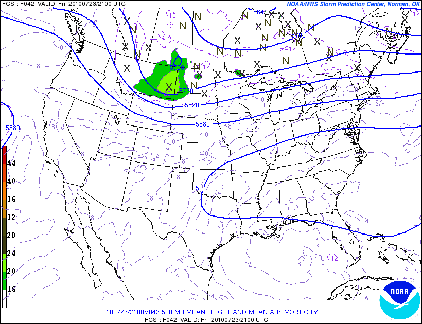
Well that was wild. Yesterday I wrote the greens were under the gun for some severe storms- and boy did some pop up. If you look at the SPC severe weather reports from yesterday you get a sense of just how darn active yesterday was:
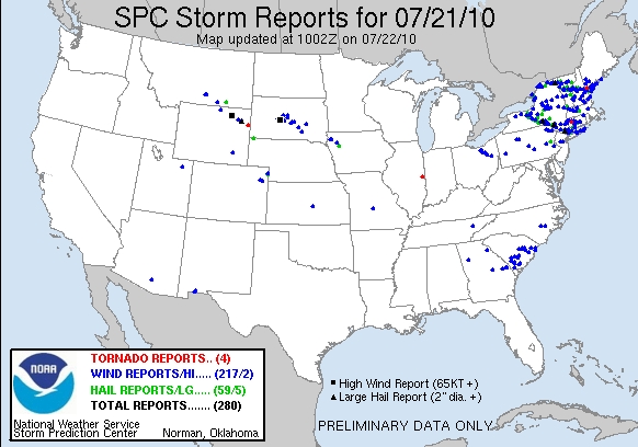
There was hail, winds in excess of 70 miles per hour and several severe thunderstorms with Doppler indicated rotation. Nasty all over. While we talk about the dangers of cold and winter weather, nothing is more dangerous to the outdoor enthusiast than a severe thunderstorm and its powerful cloud to ground lightning. They are not to be taken lightly. I’ve been caught out during one and would not wish to repeat the experience! Gotta be careful and heed these warnings.
As for the coming weekend, I don’t see a repeat of yesterday despite there being the chance for another round of t-storms.
| Jump to: | Synopsis | Friday | Saturday | Sunday | Extended |
SYNOPSIS:
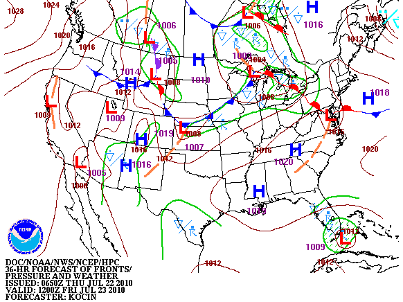
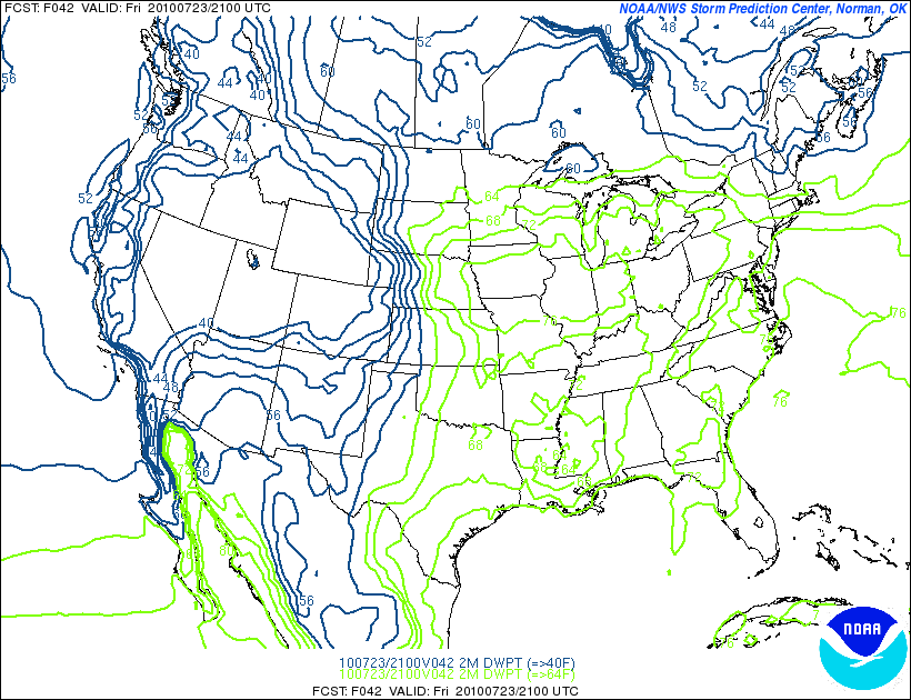
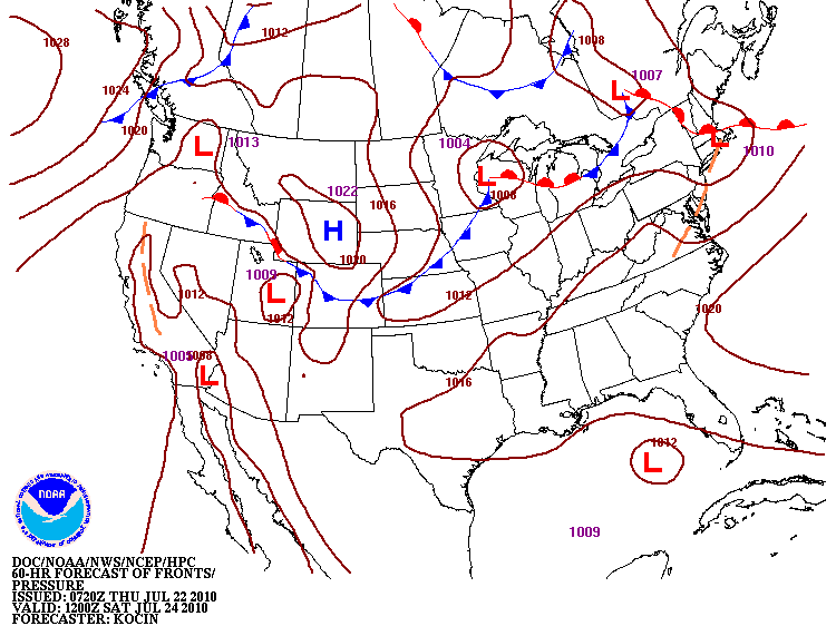
Overall the weekend will bring a mixed bag of summer weather. Friday will start nice with a warm front pushing in from the sw throughout the day. This will bring a chance for scattered t-storms and showers later in the day along with an increase in temps and humidity. As we move into Saturday, a system will be working along the St. Lawrence valley. This will bring another chance of storms to the north country although the primary concern will be from the trailing cold front attached to the system. This front should cross the region Saturday night into Sunday. As it does it has the chance to set off some wet storms. The timing should preclude severe weather but with high p-wats I could see the system spitting out some heavy rain. This should all clear by sunday am for the most part. As Sunday wears on a noticeable change should be pretty clear as temps drop with drying winds from the nw.
| Jump to: | Synopsis | Friday | Saturday | Sunday | Extended |
FRIDAY:
Friday will be a day of transition. Friday will start out pleasant but as a system works out of the great lakes it will push a warm front in from the SW. This will warm the airmass and increase dewpoints. As the front moves in from the SW it will also bring with it a chance for showers and a few (unlikely severe) t-storms.
UPDATE
Precip shield from front is a little faster and more robust than previously modeled. Looks like ADKs and catskills will some more widespread shower activity this morning.
END OF UPDATE
Primary Concerns:
Stray t-storm in the afternoon and a greater shower coverage from the warm front.
Best Location:
The northern greens look good as do the whites. The chance for t-storms/showers should hold off until later in the day – say until 2 or 3 pm and the pops are lower after that anyway.
Best Activity:
With the recent heavy rains a whitewater kayak might be possible. Other than that all are pretty much equal.
Recreational Forecast:
By Friday morning weak high pressure will be over the NY, Mass, VT and NH.
This high is associated with some nice dry air
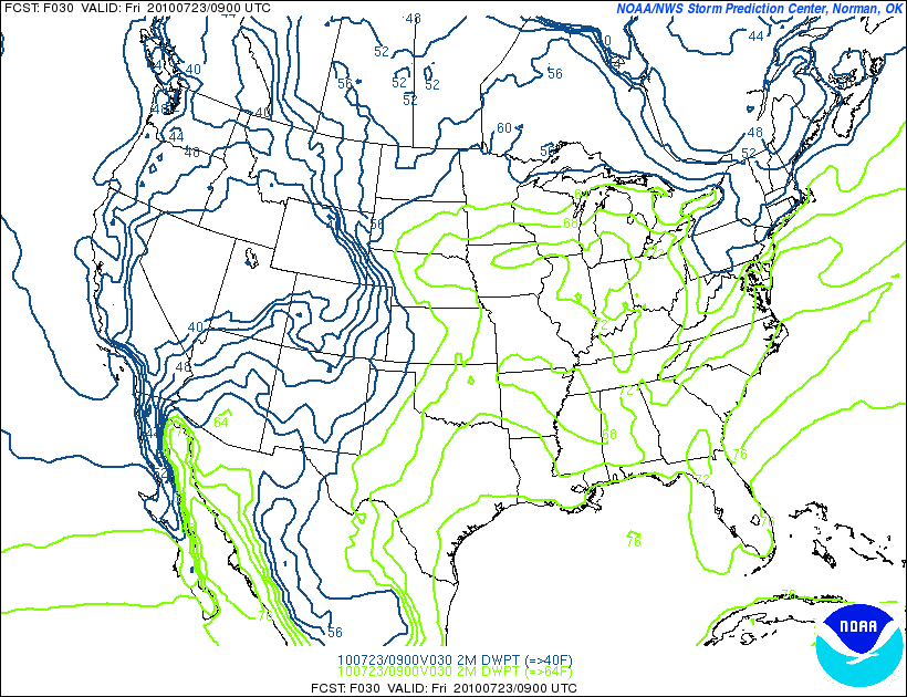
However, as the front pushes in the dewpoints will rise by the afternoon
South of that, a large bubble of high pressure will be building. This will be filled with some hot air.
However, I don’t think that heat will make it all the way into the north country. Temps should remain in the 70s and low 80s.
Now the real issue for the day is how far that front gets. HPC slows the front down so that it doesn’t really push into the north country until later in the day. Other models are more progressive and bring the front all the way up into the ADK by mid afternoon. Regardless, the lifting front will set off some scattered showers. The chance for a t-storm is minimal the further north you get. Best chances for a t-storm are in the Catskills and specifically the western catskills. Regardless, I’d expect to see some showers from the Catskills north through the ADK and Greens at some point Friday afternoon. It just makes sense.
| Jump to: | Synopsis | Friday | Saturday | Sunday | Extended |
SATURDAY:
Saturday will be a moist day. To the south temps and humidity will combine to make it feel hot. This of course isn’t a surprise because it’s been hot all summer. Towards the north, the low pressure working its way across the St. Lawrence valley will push a cold front into the region in the late evening and afternoon.
Primary Concern:
Stagnant moisture around old warm front creating gross wet clouds. Esp. in the mountains. These systems have a way of just getting all caught up and creating a wet blanket that hangs around. It’s always a concern with set ups like this. If so to day could feel much wetter than it actually is.
Second issue is convection from approaching cold front Saturday afternoon. Again while severe weather looks limited, with high pwat values a quick 1-2 inches of rain is possible.
Best Areas:
While the heat will be something to contend with, areas to the south might have the best chance of staying sunny and dry throughout the day.
Best Activity:
Really mixed on this. There isn’t one activity to avoid but there also isn’t really one particularly good activity.
RECREATIONAL FORECAST:
By Sat. morning the warm front will have pushed well north and a low pressure system will be moving along the St. Lawrence.
To the south, a large ridge of hot air will be wilting the midatlantic.
As the system over Canada works to the east, it will skirt the border and push a cold front into the region. This front looks to arrive sometime later in day. I’d suspect sometime between 6pm and midnight based on the guidance I see right now.
Ahead of the front temps will be above average with relatively sticky humidity levels. If the sun pokes out you might see some decrease in RH. If it doesn’t however the day could feel really moist.
Once the front does arrive it should set off a round of rather heavy rain showers.
| Jump to: | Synopsis | Friday | Saturday | Sunday | Extended |
SUNDAY:
Sunday will be another transition day. The front should work through the region throughout the morning and may even be off the coast by daybreak. Behind the front a nice high pressure system will build in.
Timing is screwy right now because there are a number of low pressure centers that the models have all hooked the front too. Regardless I think the pattern for Sunday is pretty clear even if the hour-by hour isn’t.
Primary Concern:
Lingering showers from Saturday’s cold front and delayed clearing.
Best Areas:
If the timing works out the Adirondacks and Northern Greens could be sweet. They could see clear afternoon skis with seasonable to below average temps and crisp air.
RECREATIONAL FORECAST:
By Sunday am, the front will be on the move to the east. This will act to clear out some the damp and warm air that plagued the region on Saturday. Building high pressure and winds from the NW will work to dry the region out and bring temps back to seasonable norms. A below average reading is even possible. In certain places we might not even hit the 70s. (Sounds nice doesn’t it).
While clouds may take a while to clear out, by the afternoon sun will work into the Adirondacks, Greens with some rays poking out into NH, So. VT and the Catskills.
What’s most remarkable however is that Sunday night, if the skis clear just right the above areas might actually see the first “cool” night in a long time. Right now a good deal of guidance is suggesting temps will fall into the very low 50’s at night. Now maybe it’s my thin blood but that’s cool for me and sounds very appealing given that Philly has had about 9,000,000 days over 90 degrees this summer.
| Jump to: | Synopsis | Friday | Saturday | Sunday | Extended |
Extended outlook
Monday should be a really nice day. Seasonable high pressure will make for a splendid day that carries into Tuesday.

One Comments
|
|||
| Home |

-
Search
New Comments
macbook repair seattle said: “macbook repair seattle Let’s get it started...(read more)” about Let’s get it started
Greg said: “Thanks for all this great info. And...(read more)” about Skiing Mt. Colden’s Trap Dike
Greg said: “Definitely late, but always welcome!” about Skiing Mt. Colden’s Trap Dike
Bob said: “[* Shield Security plugin marked this comment...(read more)” about Skiing Mt. Colden’s Trap Dike
Regular paint Maintenance said: “Regular paint Maintenance Behind The Schuss(ic) :...(read more)” about Behind The Schuss(ic)
The 2012-13 Ski Season in Photos #13 | NY Ski Blog said: “[…] tweeting about big Memorial Day snow...(read more)” about pow
ml242 said: “LuckyLuc and MadPat on the same day?...(read more)” about Deep Cover Anthropology
Talbert said: “Long time no comment..... But great to...(read more)” about Man of Many Moods
Twitter Feed
-
Categories
- Skiing (438)
- Weather (188)
- WTF (5)
- Quick Update (173)
- Full Trip Report (165)
- WebiGNARs (45)
- General Interest (38)
- Site News (27)
- Summer (59)
- Hiking (26)
- Swimming (15)
- Climbing (13)
- Longboarding (3)
- Whitewater Kayaking (2)
- Mountain Biking (1)
- SPA (16)
- Gear Review (8)
-
Archive
- October 2018
- June 2017
- November 2016
- October 2016
- March 2016
- January 2016
- October 2015
- February 2015
- January 2015
- December 2014
- November 2014
- October 2014
- September 2014
- July 2014
- April 2014
- March 2014
- February 2014
- January 2014
- December 2013
- November 2013
- October 2013
- September 2013
- August 2013
- June 2013
- May 2013
- April 2013
- March 2013
- February 2013
- January 2013
- December 2012
- November 2012
- October 2012
- September 2012
- August 2012
- July 2012
- June 2012
- May 2012
- April 2012
- March 2012
- February 2012
- January 2012
- December 2011
- November 2011
- October 2011
- September 2011
- August 2011
- July 2011
- June 2011
- May 2011
- April 2011
- March 2011
- February 2011
- January 2011
- December 2010
- November 2010
- October 2010
- September 2010
- August 2010
- July 2010
- June 2010
- May 2010
- April 2010
- March 2010
- February 2010
- January 2010
- December 2009
- November 2009
- October 2009
- September 2009
- August 2009
- July 2009
- June 2009
- April 2009
- March 2009
- February 2009
- January 2009
- December 2008
- November 2008
- October 2008
- April 2008
- March 2008
- February 2008
-
Friends of F.I.S.

About Us:
We are a group of powder hungry, east-coast-bred, world-traveling skiers and riders who Earn Our Turns to bring you the best stoke a click-of-the-mouse can buy.We hope our adventures inspire you to Earn Your Turns as well!
LEARN MORE

Latest Weather
When one makes meatballs, one must begin with quality meats: ...
Read more in: Meatballs! (read more)
Ben
wrote on July 22nd, 2010 at 3:17 pmthanks for the heads up on those storms yesterday… they dumped a LOT of rain in a few choice locations, making the New Haven Ledges AWESOME today!!! closest thing we get to a powder day in the summer…
Any thoughts on the most favored locations for rain (>1″ probably) in the next few days? or is that just wishful thinking?