
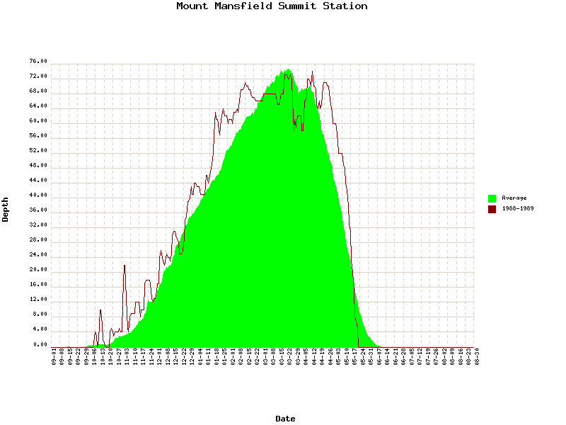
It’s been hot. Record hot. In fact the last time it was this hot in July, was 1988. So of course being a winter obsessed I wanted to see what the winter of 1988-89 was like. Starting with the Mt. Manny snow depth we see that it featured generally above average snow depths:
Looking at some teleconnection numbers, however, it seems that winter wasn’t particularly harsh:
AO for Jan 1989-March 1989: 3.106, 3.279 1.530
NAO for Jan 1989- March 1989: 1.17 2.00 1.85
Now without getting crazy and throwing around more numbers (as I’m prone to do), the best I can say is that there is little correlation between a record heat wave and the following winter. There is much better correlations between the number of 90+ degree days and the following winter, but we’ll cross that bridge when we come to it. On to the weekend!
| Jump to: | Synopsis | Friday | Saturday | Sunday | Extended |
SYNOPSIS:
Relief is on the way. However it will come with some rain and the potential for very heavy downpours later Friday afternoon into Sat. Following, Sunday looks to clear in much of the north country with a weak wave developing along the coast and impacting south-eastern VT/NH/Conn/Mass and parts of ME.
| Jump to: | Synopsis | Friday | Saturday | Sunday | Extended |
FRIDAY:
Friday will be a day that begins like the previous five and ends with the wheels of change in full movement. The deep and stale ridge that has pumped record breaking heat, junky air and now moisture into the NE will begin to break down. As it does and slides east a front will push in from the west. Given high pwat values and the sluggish nature of the front isolated to scattered heavy downpours will be possible later Friday afternoon into the night from the front’s passage.
Shear profiles and CAPE signatures however suggest that the convective potential is minimal and any thunderstorms that do develop should be fairly weak and isolated. Timing the font is tricky. Some guidance wants to bring some pre-frontal precip into the area around 2pm while a large suite of models hold off the precip until at least 5pm. I’ll go into detail further down but I’m inclined to go with the 5pm time frame.
Primary Concerns: Heavy downpours resulting in isolated flash flooding.
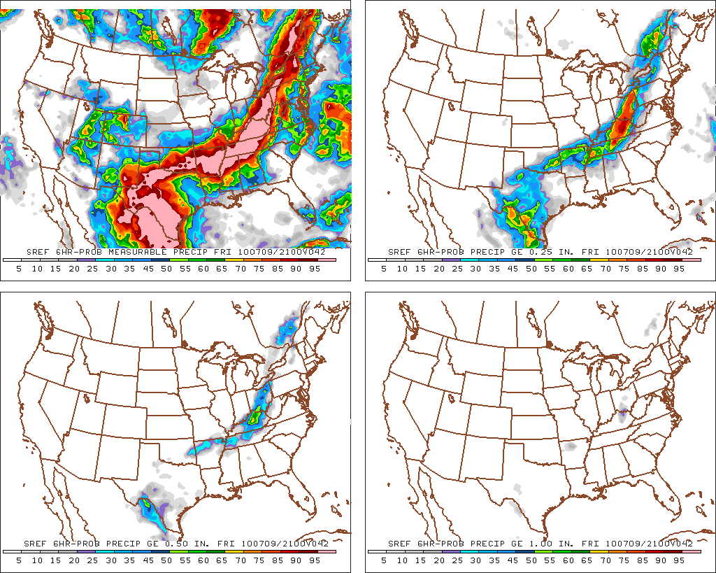
Looking at the most current flash flood guidance:
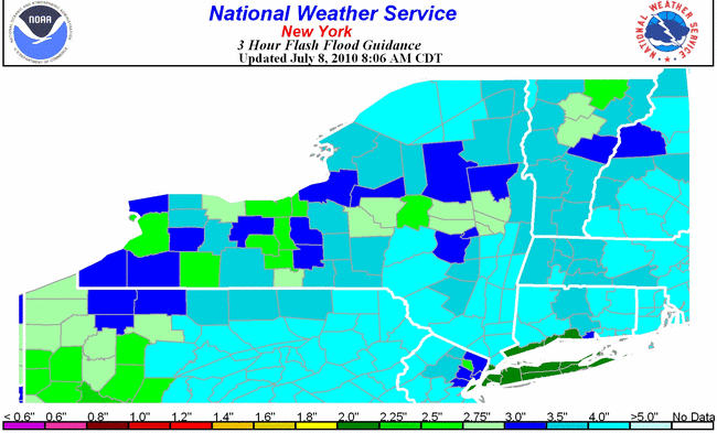
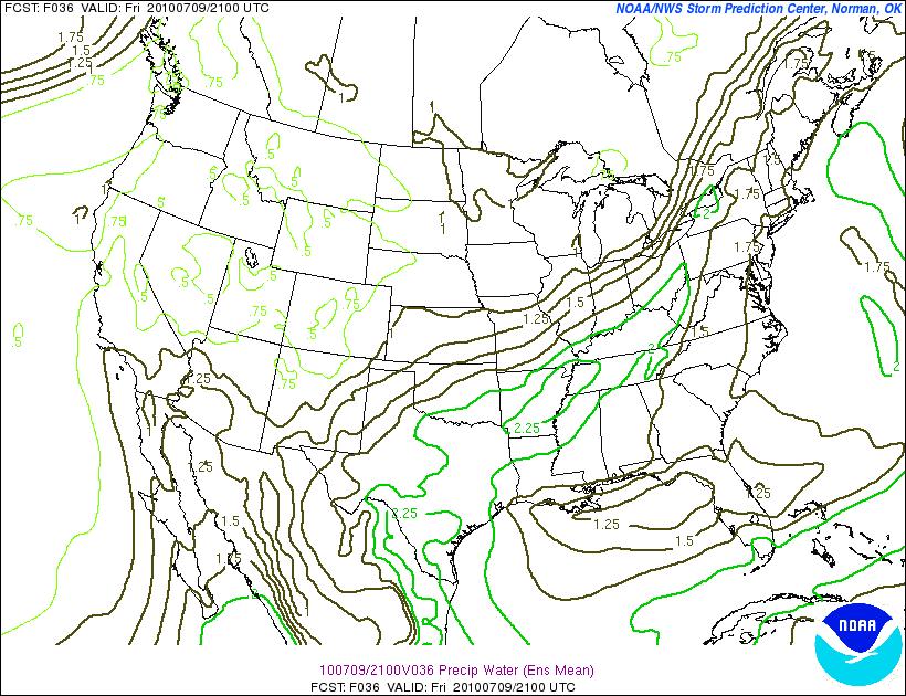
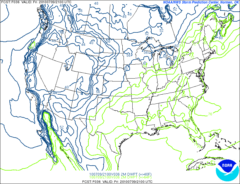
we see that for the most part the NE has been pretty dry and only fairly extreme 3 hour rainfalls would trigger flash flooding. However, with Pwat (that’s precipitable water…I know were getting a glossary) values fairly high:
and weak wind fields the potential for some flash flooding can’t be ignored if small series of heavy downpours trains in one area.
While I think flash flooding is less of a problem than wet rocks, a heavy downpour can make small streams impassable or at the very least, turn them into ankle breakers. So if you head out Friday- and by all means its worth doing if you are prepared-pick a good route that doesn’t require crossing moderate streams late in the day. No need to be stuck out there or hike three miles back to a bridge if you can plan ahead!
Of course as for you kayakers out there…you might want to follow the radar and maybe get a late evening ride in wherever the heaviest precip sets up.
Best Location:
Given the timing of the front I think all the major outdoor destinations will be fine for the most part on Friday. However, if you want to avoid having to pack a rain shell and pay attention to the skies, head east. Eastern VT, and NH should stay dry for most of the (NEW LIONEL TERM ALERT!!!!) “outdoor hours” (you know 7am till 5pm) on Friday.
Best Activity:
Again, all summer sports are in play for much of the day Friday. Personally I’m going hiking. Climbing would be nice, swimming dandy and boating equally fun. Just watch the skies starting around 2pm and make smart choices. A good day with a wet finish is still better than sitting around doing work. (Yea yea…I can hear you now Ms. Hutz…there I go doing it again…well whatever!)
Recreational Forecast:
Friday will begin with the stale ridge still in place. However it will break down over the daylight hours on Friday. Before it does however, it will send temps above normal for another day.
However because of the position of the high, temps should be a notch or two below what they have been.
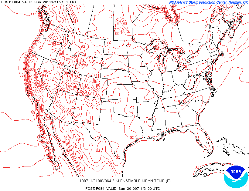
I’m thinking based on the mean SREF numbers that we’re looking at low 80s for the mountains and mid/upper 80s for the valleys in the NE.
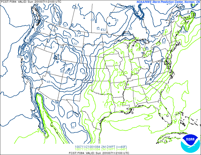
However, with rather high dew points it will feel about the same.
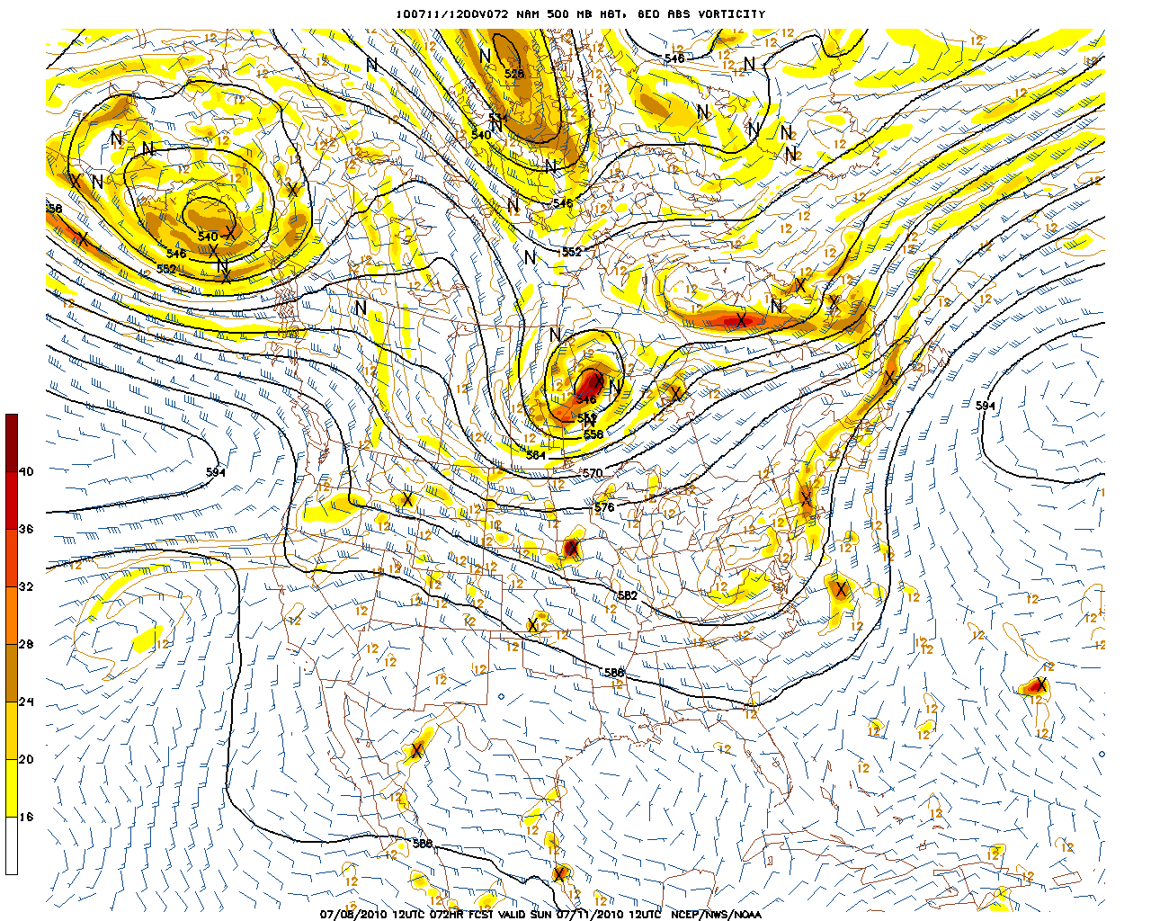
Now as the afternoon progresses, a front will work in from the west. The timing of this front is the trickiest element of the forecasting.
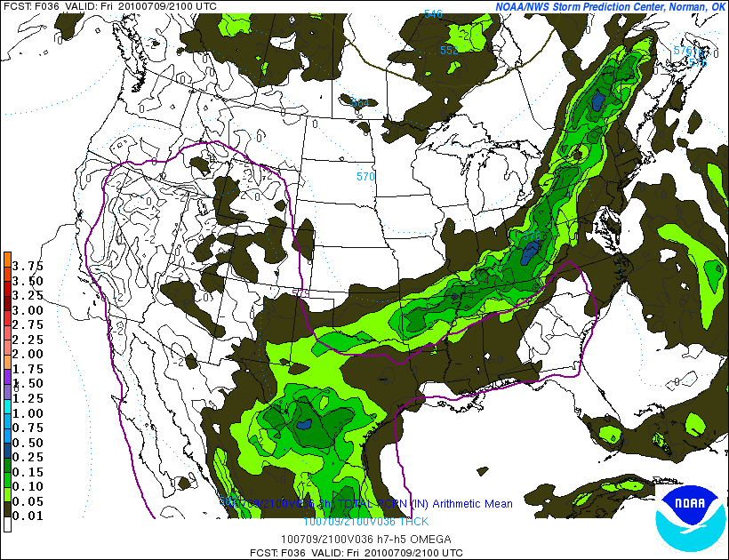
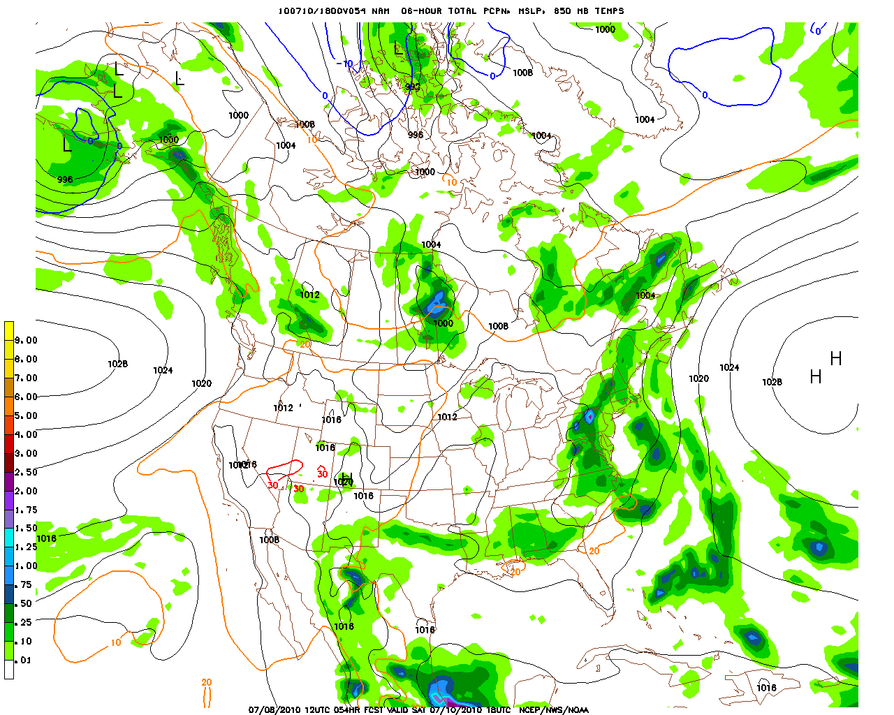
Looking at the models we see a general agreement that the front shouldn’t push into the north country until around 4pm or so on friday.
The 03z Ensemble suite, the 09 SREF, and one of the high res WRF models all hold the precip off until around 21z (5pm).
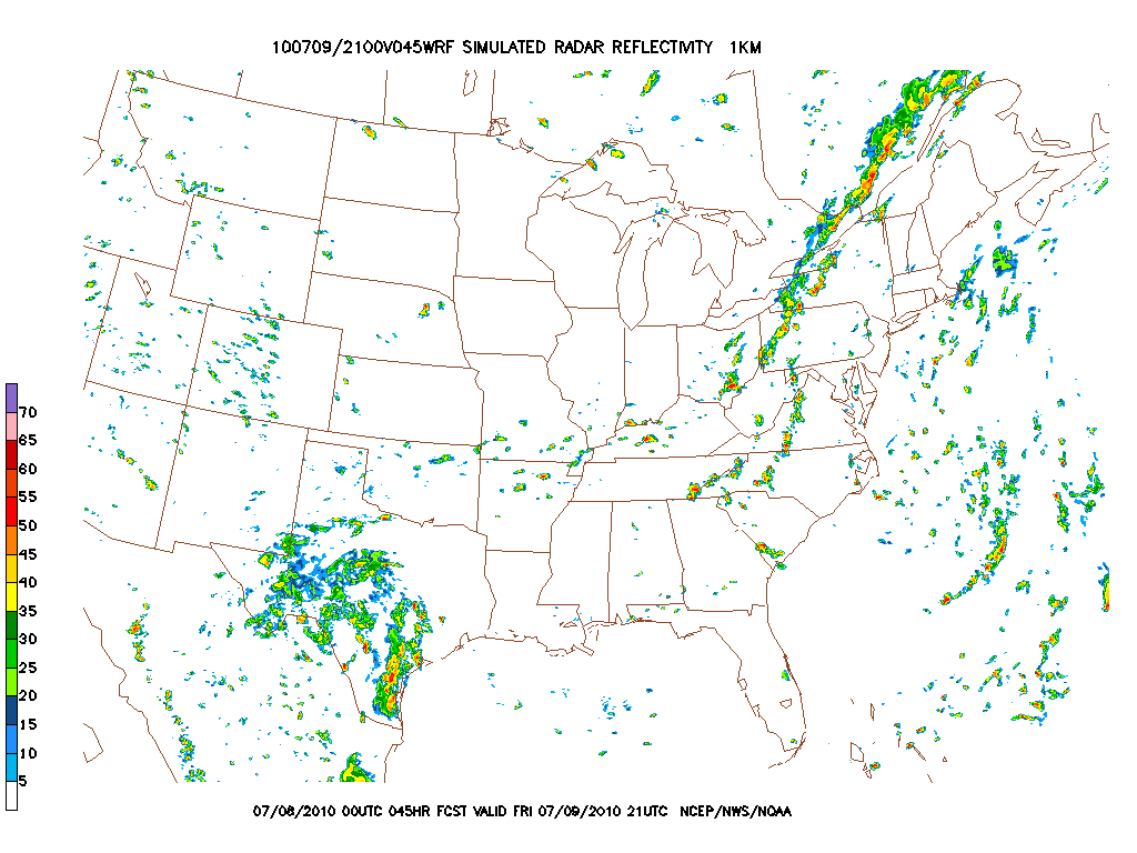
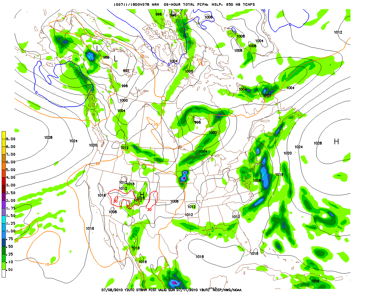
The other high res model is a little earlier and more widespread with the onset of precip:
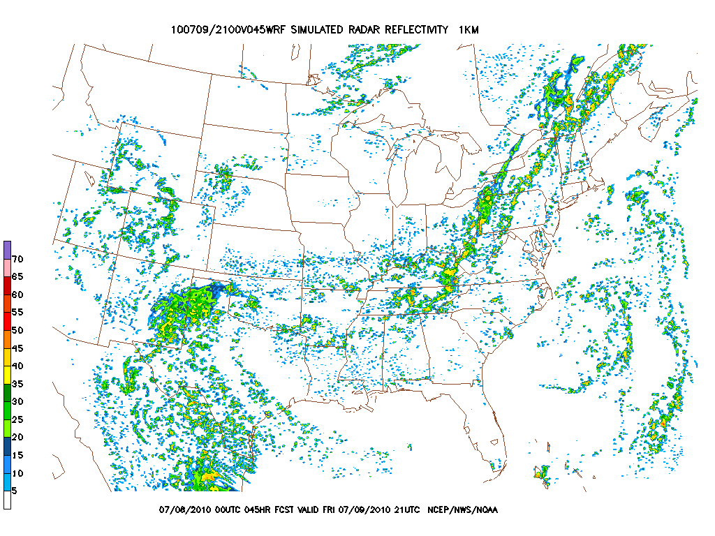
Based on this summer, this model is way overdone with precip amounts and is prob. simply indicating the presence of building clouds in the moist atmosphere.
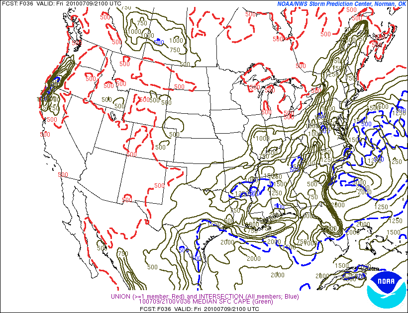
Given the approaching front, and moist warm airmass you have to consider the potential for t-storms.
Looking at the Sufrace CAPE forecasts:
and the Lifted Index
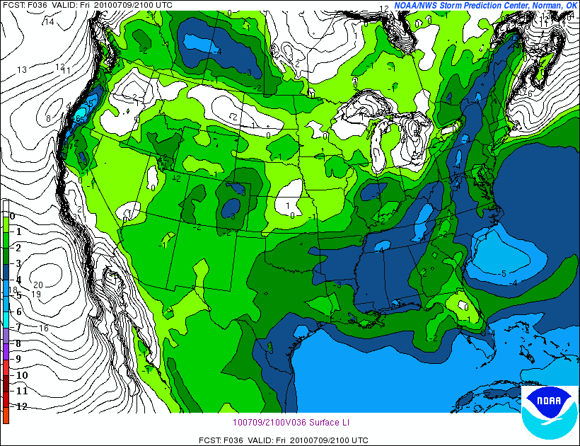
it seems possible that some convection should flare up. However the shear profiles don’t really support the development of super cells. At best I’d put the chance for an isolated mild T-storm at around 30% late Friday afternoon. A downpour is much more likely.
| Jump to: | Synopsis | Friday | Saturday | Sunday | Extended |
SATURDAY:
Saturday will be a day of transition as the front sags along towards the coast.
Primary Concern:
Lingering showers behind it and continuing showers across S. VT and NH as the front stalls and a weak wave of low pressure moves up the coast.
Best Areas:
Northwestern portions of the area have the best chance of seeing some nice clearing behind the front.
Best Activity:
Whitewater could be up early in the AM so that could be a change after the dry summer we’ve had. By the afternoon when it clears, just about everything should be good. Maybe stay off the trails and letting them dry out a bit would be nice, but with how baked they are, much of the water will run right off anyway.
RECREATIONAL FORECAST:
By Saturday morning, the front will be draped across southern NY state, Conn, So. VT, Mass and NH.
With the front will come relief. Temps behind the front will only reach into the 70s.
The air will be moist however so don’t expect a crsip day.
As the front is to the S/E most of the precip associated with the front should remain there as well.
Now here is where it gets annoying. The GFS and the NAM both want to develop a low pressure wave along this frontal boundary. However they diverge regarding the timing.
The NAM holds it off until Sunday:
while the GFS start getting it together on Saturday afternoon:
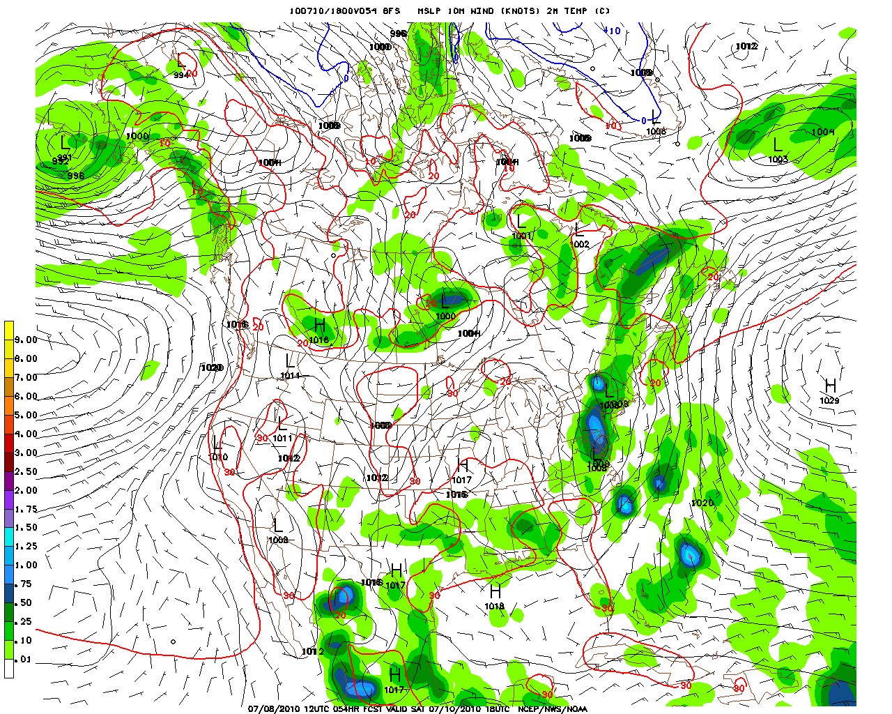
The GFS then wraps it up tight as winter nor’easter and tracks it up into New England into Sunday, bringing rain on Sunday to NH, ME and parts of eastern VT. The Nam keeps it more open and simply forecasts some enhanced precip along the frontal boundary in the above areas.
Regardless, by Saturday afternoon, the ADK, Catskills and NW VT should see some legit clearing of the skies.
| Jump to: | Synopsis | Friday | Saturday | Sunday | Extended |
SUNDAY:
Sunday should nice for much of the region as the frontal boundary and Low pressure wave push off to the east and temps hover in the seasonal realm.
Primary Concern:
Enhanced precip from the low pressure wave extending futher than anticpated.
Best Areas:
The ADK and NW VT. These areas should be well enough behind the front to miss out on the precip associated from the low.
RECREATIONAL FORECAST:
By sunday morning the front should be draped across the eastern edge of the NE. A weak low pressure wave will ride along it and bring some enhanced precip to New England.
Here we see the mean position of the impulse by sunday am. X marks the spot!
To the west, the skies should be clear and a nice day (potentially the best of the weekend) should be unfolding.
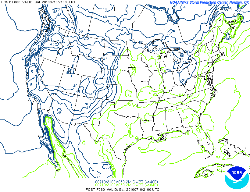
Temps will hover in the 70s and low 80s.
and dew points will be noticeably lower:
I’ll try to update Sunday w/r/t that low pressure wave but I’ll be in the woods. At best check our radar and email me for updates!
| Jump to: | Synopsis | Friday | Saturday | Sunday | Extended |
Extended outlook
Monday and Tuesday look to have a ridge build back into the region. However it will not have the heat pump effect of the last one. Temps will be slightly above norm and skies should be clear.

Leave a Reply
|
|||
| Home |

-
Search
New Comments
macbook repair seattle said: “macbook repair seattle Let’s get it started...(read more)” about Let’s get it started
Greg said: “Thanks for all this great info. And...(read more)” about Skiing Mt. Colden’s Trap Dike
Greg said: “Definitely late, but always welcome!” about Skiing Mt. Colden’s Trap Dike
Bob said: “[* Shield Security plugin marked this comment...(read more)” about Skiing Mt. Colden’s Trap Dike
Regular paint Maintenance said: “Regular paint Maintenance Behind The Schuss(ic) :...(read more)” about Behind The Schuss(ic)
The 2012-13 Ski Season in Photos #13 | NY Ski Blog said: “[…] tweeting about big Memorial Day snow...(read more)” about pow
ml242 said: “LuckyLuc and MadPat on the same day?...(read more)” about Deep Cover Anthropology
Talbert said: “Long time no comment..... But great to...(read more)” about Man of Many Moods
Twitter Feed
-
Categories
- Skiing (438)
- Weather (188)
- WTF (5)
- Quick Update (173)
- Full Trip Report (165)
- WebiGNARs (45)
- General Interest (38)
- Site News (27)
- Summer (59)
- Hiking (26)
- Swimming (15)
- Climbing (13)
- Longboarding (3)
- Whitewater Kayaking (2)
- Mountain Biking (1)
- SPA (16)
- Gear Review (8)
-
Archive
- October 2018
- June 2017
- November 2016
- October 2016
- March 2016
- January 2016
- October 2015
- February 2015
- January 2015
- December 2014
- November 2014
- October 2014
- September 2014
- July 2014
- April 2014
- March 2014
- February 2014
- January 2014
- December 2013
- November 2013
- October 2013
- September 2013
- August 2013
- June 2013
- May 2013
- April 2013
- March 2013
- February 2013
- January 2013
- December 2012
- November 2012
- October 2012
- September 2012
- August 2012
- July 2012
- June 2012
- May 2012
- April 2012
- March 2012
- February 2012
- January 2012
- December 2011
- November 2011
- October 2011
- September 2011
- August 2011
- July 2011
- June 2011
- May 2011
- April 2011
- March 2011
- February 2011
- January 2011
- December 2010
- November 2010
- October 2010
- September 2010
- August 2010
- July 2010
- June 2010
- May 2010
- April 2010
- March 2010
- February 2010
- January 2010
- December 2009
- November 2009
- October 2009
- September 2009
- August 2009
- July 2009
- June 2009
- April 2009
- March 2009
- February 2009
- January 2009
- December 2008
- November 2008
- October 2008
- April 2008
- March 2008
- February 2008
-
Friends of F.I.S.

About Us:
We are a group of powder hungry, east-coast-bred, world-traveling skiers and riders who Earn Our Turns to bring you the best stoke a click-of-the-mouse can buy.We hope our adventures inspire you to Earn Your Turns as well!
LEARN MORE

Latest Weather
When one makes meatballs, one must begin with quality meats: ...
Read more in: Meatballs! (read more)