
Thanksgiving weekend: Giving Thanks or Day in the Tank? UPDATED 11/17
Look after the jump to see NWS starting to agree that a colder period should arrive around Thanksgiving.
As my office building creaks and groans in the midst of this wasted ‘Noreaster I decided to take a minute to look ahead to Thanksgiving weekend.
For many ski areas “black Friday” has become the targeted opening day. Why? Well several reasons. It’s late enough to allow for consistent nighttime snowmaking leading up the day, people are off work and able to ski, and it’s a month before the make or break holiday season. Gotta get people in the mood for skiing if you want them to shell out the green over Xmas. As most of us don’t hike a few thousand vertical feet in October to trash up some skis on three inches of slush like these FIS yahoos do, the Black Friday also marks the opening day of our season. With that in mind I bet many of you are thinking “Will there be any snow?” My answer: I have no idea.
Don’t take this as a “glib” (Thanks TomKat) response. Any weatherman worth his “salt” (Thanks pre-gold standard trade and barter system) should admit that two weeks away from a particular day, he or she s no real clue what the weather will be on that day. Sure we can guess based on the average for that day, the trends, the teleconnection patterns and the way the butterflies are migrating in Brazil, but the truth is, two weeks is an ETERNITY in weather and anything can happen. Now that we’re clear on that, here are my thoughts.
Currently, we’re in a really shitty (real weather term right there) pattern for winter weather.
We have a positive NAO (bad #1)

A positive AO (bad #2)

A bad PNA (bad #3)

Add all these three connections up, throw in a strengthening El Nino and the recent stretch of warm weather (big fan of persistence here) and you have two weekends (last and upcoming) where highs will be well above normal for this time of year and chances for snowfall are nil
There is good news however. If you look at ALL the above data you see each index is forecasted to move from BAD to GOOD within the next 10 days or so. Personally this makes sense. Patterns last 4-8 weeks. Since we had that nice stretch back in late September we’ve been in this warmer pattern. Timing-wise I’ve basically plotted turkey day as a pattern shift day and these models agree that sometime soon we’ll see a shift to a colder pattern. How profound this change is and how long cold air lasts however is uncertain. Just because we see a shift to a more favorable NAO/AO/PNA doesn’t mean we’ll have last year’s opening day:
UPDATE:
NWS starting to agree with the FIS weather team:
8-14 DAY OUTLOOK FOR NOV 24 – 30 2009
TODAYS GFS ENSEMBLE MEANS ARE IN VERY GOOD AGREEMENT ON MEAN 500 HPA
CIRCULATION PATTERN FOR THE WEEK 2 PERIOD PREDICTING THE TROUGH OVER THE CONUS
TO SHIFT EASTWARD. THE CANADIAN ENSEMBLES DEPICT A LESS AMPLIFIED TROUGH OVER
THE CENTRAL US. THE GFS OPERATIONAL SOLUTIONS ARE IN GOOD AGREEMENT ON THE
EASTWARD SHIFT OF THE TROUGH OVER CONUS. THE GFS ENSEMBLE MEANS AND THE THREE
MOST RECENT GFS OPERATIONAL SOLUTIONS FORECAST NEAR TO BELOW NORMAL HEIGHTS
ACROSS THE SOUTHERN THIRD OF CONUS AND FROM THE PLAINS EASTWARD AND POSITIVE
HEIGHT ANOMALIES OVER THE NORTHWEST US. THE CANADIAN ENSEMBLES DEPICT NEAR
AVERAGE HEIGHTS ACROSS THE SOUTHERN CONUS.
THE CURRENT MJO ACTIVITY ADDS CONSIDERABLE UNCERTAINTY TO THE WEEK-2
FORECAST. DURING THIS PERIOD, ENHANCED TROPICAL RAINFALL IS EXPECTED TO
ESTABLISH ITSELF ACROSS THE WESTERN PACIFIC OCEAN. IF SO, THE
CIRCULATION REGIME ACROSS THE PACIFIC-NORTH AMERICAN SECTOR MAY BE
IMPACTED. AT THE CURRENT TIME, IT APPEARS THAT THE CANADIAN HAS A MORE
CONSISTENT CIRCULATION FOR THE FORECAST MJO PHASE AND MAY BE WEIGHTED
MORE IN COMING DAYS.
TODAYS BLEND CHART IS SIMILAR TO THE 6-10 DAY PERIOD BUT THE TROUGH OVER THE CONUS IS SHIFTED SLIGHTLY EASTWARD. OTHER DIFFERENCES INCLUDE POSITIVE HEIGHT ANOMALIES OVER EASTERN ALASKA AND NEGATIVE HEIGHT ANOMALIES OVER THE SOUTHEAST
US AND THE MID-ATLANTIC REGION.
GREATER CHANCES FOR BELOW AVERAGE TEMPERATURES ARE FORECAST FOR MOST OF THE
CENTRAL AND EASTERN US BENEATH OF THE TROUGH, WHILE GREATER CHANCES FOR ABOVE
AVERAGE TEMPERATURE ARE FORECAST FOR ALASKA AND THE WESTERN US UNDERNEATH THE
FORECAST RIDGE. ENHANCED PROBABILITIES FOR BELOW MEDIAN PRECIPITATION ARE
FORECAST BENEATH FORECAST POSITIVE HEIGHT ANOMALIES OVER ALASKA AND PARTS OF
THE WESTERN US, ALTHOUGH NEAR MEDIAN PRECIPITATION IS FORECAST IN THE PACIFIC
NORTHWEST AND NEAR THE US WEST COAST DUE TO POSSIBLE MJO INFLUENCES. ENHANCED
PROBABILITIES FOR ABOVE MEDIAN PRECIPITATION ARE FORECAST FOR THE SOUTHEAST US
AND MOST OF THE EAST COAST DOWNSTREAM OF THE TROUGH AXIS.

10 Comments
|
|||
| Home |

-
Search
New Comments
macbook repair seattle said: “macbook repair seattle Let’s get it started...(read more)” about Let’s get it started
Greg said: “Thanks for all this great info. And...(read more)” about Skiing Mt. Colden’s Trap Dike
Greg said: “Definitely late, but always welcome!” about Skiing Mt. Colden’s Trap Dike
Bob said: “[* Shield Security plugin marked this comment...(read more)” about Skiing Mt. Colden’s Trap Dike
Regular paint Maintenance said: “Regular paint Maintenance Behind The Schuss(ic) :...(read more)” about Behind The Schuss(ic)
The 2012-13 Ski Season in Photos #13 | NY Ski Blog said: “[…] tweeting about big Memorial Day snow...(read more)” about pow
ml242 said: “LuckyLuc and MadPat on the same day?...(read more)” about Deep Cover Anthropology
Talbert said: “Long time no comment..... But great to...(read more)” about Man of Many Moods
Twitter Feed
-
Categories
- Skiing (438)
- Weather (188)
- WTF (5)
- Quick Update (173)
- Full Trip Report (165)
- WebiGNARs (45)
- General Interest (38)
- Site News (27)
- Summer (59)
- Hiking (26)
- Swimming (15)
- Climbing (13)
- Longboarding (3)
- Whitewater Kayaking (2)
- Mountain Biking (1)
- SPA (16)
- Gear Review (8)
-
Archive
- October 2018
- June 2017
- November 2016
- October 2016
- March 2016
- January 2016
- October 2015
- February 2015
- January 2015
- December 2014
- November 2014
- October 2014
- September 2014
- July 2014
- April 2014
- March 2014
- February 2014
- January 2014
- December 2013
- November 2013
- October 2013
- September 2013
- August 2013
- June 2013
- May 2013
- April 2013
- March 2013
- February 2013
- January 2013
- December 2012
- November 2012
- October 2012
- September 2012
- August 2012
- July 2012
- June 2012
- May 2012
- April 2012
- March 2012
- February 2012
- January 2012
- December 2011
- November 2011
- October 2011
- September 2011
- August 2011
- July 2011
- June 2011
- May 2011
- April 2011
- March 2011
- February 2011
- January 2011
- December 2010
- November 2010
- October 2010
- September 2010
- August 2010
- July 2010
- June 2010
- May 2010
- April 2010
- March 2010
- February 2010
- January 2010
- December 2009
- November 2009
- October 2009
- September 2009
- August 2009
- July 2009
- June 2009
- April 2009
- March 2009
- February 2009
- January 2009
- December 2008
- November 2008
- October 2008
- April 2008
- March 2008
- February 2008
-
Friends of F.I.S.

About Us:
We are a group of powder hungry, east-coast-bred, world-traveling skiers and riders who Earn Our Turns to bring you the best stoke a click-of-the-mouse can buy.We hope our adventures inspire you to Earn Your Turns as well!
LEARN MORE

Latest Weather
When one makes meatballs, one must begin with quality meats: ...
Read more in: Meatballs! (read more)
Greg
wrote on November 12th, 2009 at 5:40 pmlol. Nice AJ. Thanks.
Looks like the AO is dead flat. Is that bad data?
Also what are the gaps in the NAO and PNA data? I’ve never seen that before? Budget cuts at NOAA?
Lionel Hutz
wrote on November 12th, 2009 at 6:00 pmNOAA is dividing by Zero. Come on math guy.
Harvey44
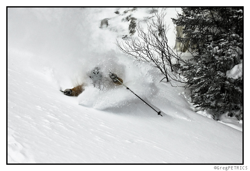
wrote on November 12th, 2009 at 11:09 pmThe pic is awesome, but kinda cruel right under those dagger to the heart charts. This is the $hit that makes us eastern skiers so passionate.
Check it out…I RSS’d you guys over on Harvey Road. (bottom right).
http://harvey44.blogspot.com/
Im_a_crappy_skier
wrote on November 13th, 2009 at 2:10 pm$%#@…thanks for the rays of hope though. I’m doing my “thingy dance” but maybe I’m doing it wrong? Left elbow rotates prior to the thigh extension or after the thigh extension?
Greg
wrote on November 13th, 2009 at 2:20 pmafter the thigh extension
Owen
wrote on November 15th, 2009 at 9:28 pmNAO/AO/PNA. That sounds like Hawaiian weather, that can’t be good.
Greg
wrote on November 16th, 2009 at 9:42 amMaybe so Owen, but I did hear Mark Breen on VPR’s Eye on the Sky say he saw colder weather coming in earnest around Thanksgiving and into December. Now where have I heard that before, and for the last month or so… hmm…. what was that?… oh that’s right: FAMOUSINTERNETSKIERS.COM/WEATHER
Greg
wrote on November 17th, 2009 at 8:15 pm@the_update ahead of the curve–the motto of the famous internet skiers
Sam
wrote on November 18th, 2009 at 9:33 amI think we should have made the site FIIC (Famous Internet Ice Climbers)instead.
Greg
wrote on November 18th, 2009 at 3:12 pmnever too late