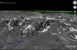
I just found out about Google Earth’s historical imagery feature. Needless to say the first thing I looked for is winter-month imagery. While there don’t seem to be many winter satellite images for the mountain regions of the Northeast, there are a couple of May views. Here’s one of The Ravines from May of 1994 (click for a larger view). Was this historically snowy, or just about average? Looks pretty good to me right about now:

I did a lot of flying around last night checking things out. Already building up a list for next year!
I guess if we can’t have winter year round in New England, the best we can do is look at satellite pictures of it!
One Comments
Leave a Reply
|
|||
| Home |


Lionel Hutz
wrote on July 29th, 2009 at 3:33 pmMay 1994 followed a snowy year.