UPDATE:
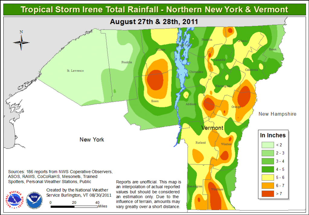
By now we’ve all seen the terrible damage brought by Irene’s rains. I’m not going to dwell on that. 5 to 10 inches of rain is a terribly destructive amount of water. We’ll recover but it’s going to be hard. For the sake of closing the loop I have posted Irene’s rainfall totals below. Sadly they were right inline with what I thought was going to happen. Floyd was a perfect match.
It could get pretty wooly this weekend as Hurricane Irene moves up the N.E. Coast. Currently the clear model consensus is for Irene to make landfall somehwere between Raritan Bay (NYC) and Cape Cod as well developed and powerful tropical cyclone.
See:
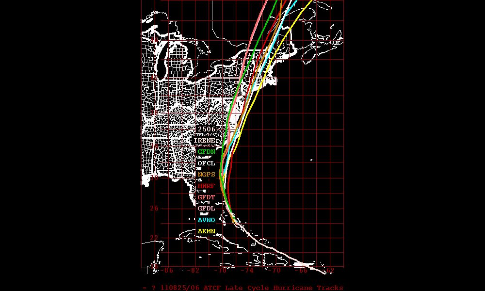
Now….I’m not going to dwell on the issues caused by powerful landfalling hurricanes and I’m certainly NOT going to say “well it’s only a Cat 2…don’t worry.” By this point we all should move away from the Saffir-Simpson scale. I believe it doesn’t accurately capture the power of hurricanes. A much better measure is Integrated Kenetic Energy. Read about it here“> If you live along the coast, a river or in a low lying area near the coast make a smart decision.
Instead, what I’d like to focus on is the potential for some serious rains in the North Country and the potential for new slides.
Roughly 12 years ago, Hurricane Floyd moved into the NE and delivered a mega dose of rain to the ADK and Greens.
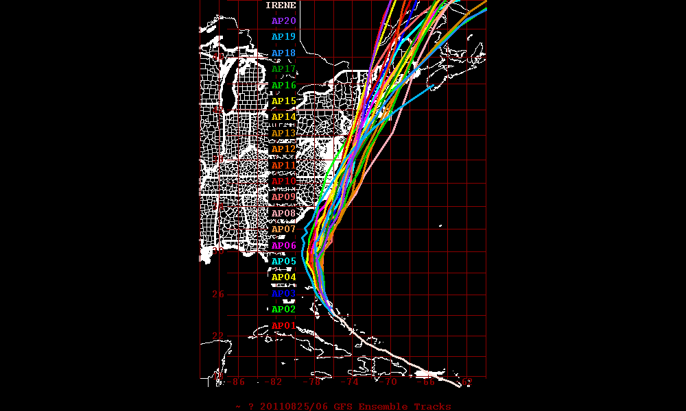
Here is Flyod’s track:
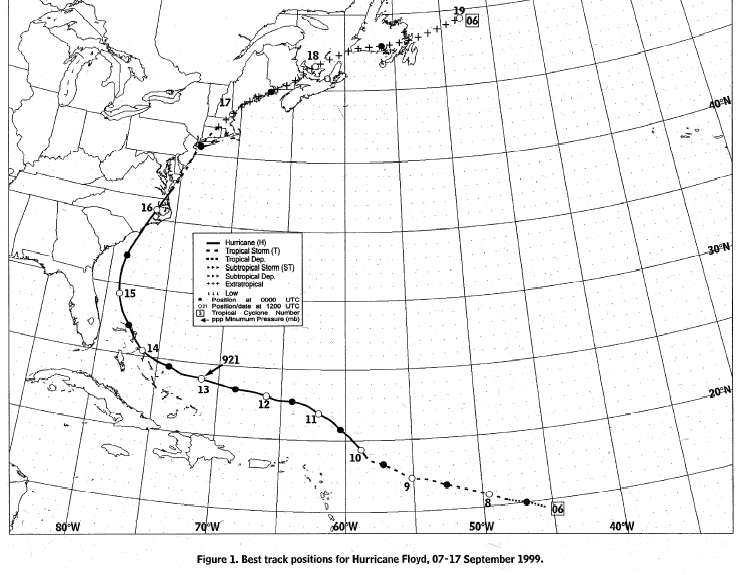
Notice anything similar with the predicted track of Miss Irene? You should.
Now here is the rainfall resulting from floyd:
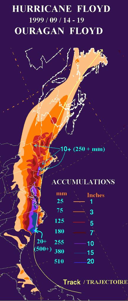
Here is one of the latest model outputs for total rainfall for Irene:
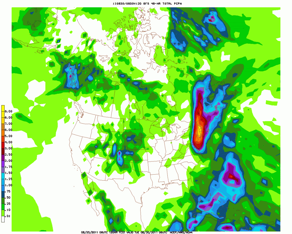
Again…notice anything similar? You should.
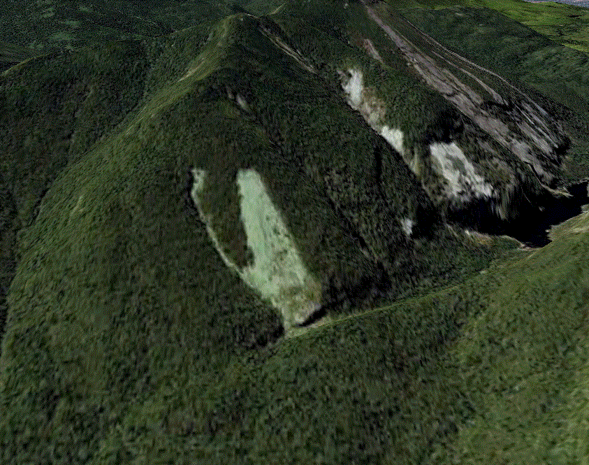
So what does (DID) this add up to. Maybe more of these: (Yes it did. Working on documenting them now).
7 Comments
Leave a Reply
|
|||
| Home |






colin_extreme
wrote on August 25th, 2011 at 12:28 pmThanks LH !
Question, has a hurricane ever dumped massive snows over VT/NY?
canucks will remember the 100cm+ that parts of nova scotia got from Juan
Sam
wrote on August 25th, 2011 at 6:20 pm^^^ the ’05 Halloween storms were the remnants of a hurricane if I remember correctly.
Lionel Hutz
wrote on August 30th, 2011 at 12:19 pmSam- they were. Tropical moisture which was the remnants of Huricane Wilma interacted with a stalled front and developing low. This produced tremendous snows on a NE wind across the N/E. Several feet were recorded. Greg and I discussed this. He told me i should get you drunk and ask about it. That and this night you spent with a goat.
robrox
wrote on August 26th, 2011 at 8:38 amGood points!
I hadn’t considered that sort of think until reading your report. On my consideration, I think it likely that the North Slides on Tripyramid and North Twin would see som big changes as the soils on those faces are so very thin and already open to the solid rock.
The Little River confluences off the Southern aspects of North Twin might get a major reshaping!
The big avalanch paths from a couple seasons ago on George could see some widening as well, maybe taking the fairly thick soils of the West Side for a ride. That might even cause a new pond to form in the Ammo.
Nice work Lionel!
icelanticskier
wrote on August 26th, 2011 at 8:43 pmwest side was sooooo 2010 rob!
rog
robrox
wrote on August 31st, 2011 at 8:00 amMan, that’s a mean damned storm! So many people lost homes and property, so many bridges and roads gone and fatalities too? Really harsh!
Right now there are more important things to do. The landslides will still be there when folks finally have some time to go look.
First things first, we can wait
chickenmeathairball
wrote on September 2nd, 2011 at 8:02 amnew adk lines are in…but dont go, it’s too steep