More Kinda Interesting Weather (Updated for Mon 12/10/12)
MONDAY 12/10/2012 AM UPDATE
Well it’s raining on the Beast Coast. For now. Today, a low pressure system will track over the Great Lakes. The associated warm front is just passing through northern VT right now. This will place the N/E in the warm sector of the storm. Temps will spike for a period today with strong southwest winds. Tonight, temps will crash back again as the cold front associated with the low passes through.
Higher resolution models shows 850 temps getting to around 0C sometime later tonight. By 1am all major models show temps at or below freezing through about 3000ft. At that point the winds will have turned and should be coming from the W/NW. The reamaining moisture in the system will flake out. I think, if this plays as the last few of these storms have played, we’ll see 3ish inches of snow by morning from 3000ft upwwards. There will likely be a few pockets above those totals along the spine of vermont in favored locations.
The system is progged to break down over the day on wednesday. Though I think we keep lingering periodicly intense snow showers going much of the day. Water totals are in the .5 to .75 range for the “snow” period 1am Tusday thru 1am Wednesday. I think those are reasonable numbers. When the pattern does break down and the snow showers stop 3-6 should have fallen with elevated pockets.
Now, there has been some rumors on the models of a second wave of low pressure developing to our south along the cold front. If that were to happen we’d see cold air advance faster and substantially more snow. I will watch closely for this today and keep you updated.
END UPDATE
I know we all like it when I start putting the VTah tags on posts or when I start talking about moisture flux from the Great Salt Lake. But not every period of weather supports such gawdy words. Sometimes, there is just weather. Good old fashioned weather.
Overall, the pattern will be dominated in the nearish term by a low rotating off the coast of Alaska and BC and a storm amplifying along the Canada/US plains border along with a broad upper level trough stretching across Wash/Oregon/Idaho/MT.
Put all these features together and the primary axis of snowfall will be the Pacific Northwest as one wet distubance after another ripples along the edge of the trough. Snowfall in these areas will be steady over the next week with several feet piling up in many locations when all is said and done.
I mean look at the total water eqiv precip predicted thru sat. am:
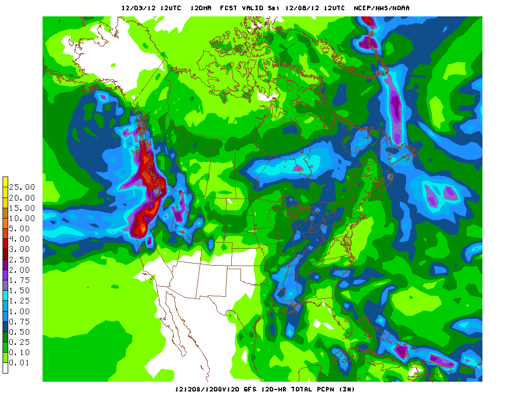
Simply put, that’s a LOT of snow in the PACNW, ID and Jackson region. However, given the moisture feed and temperature profile I’d say Jackson Hole is the place to be:
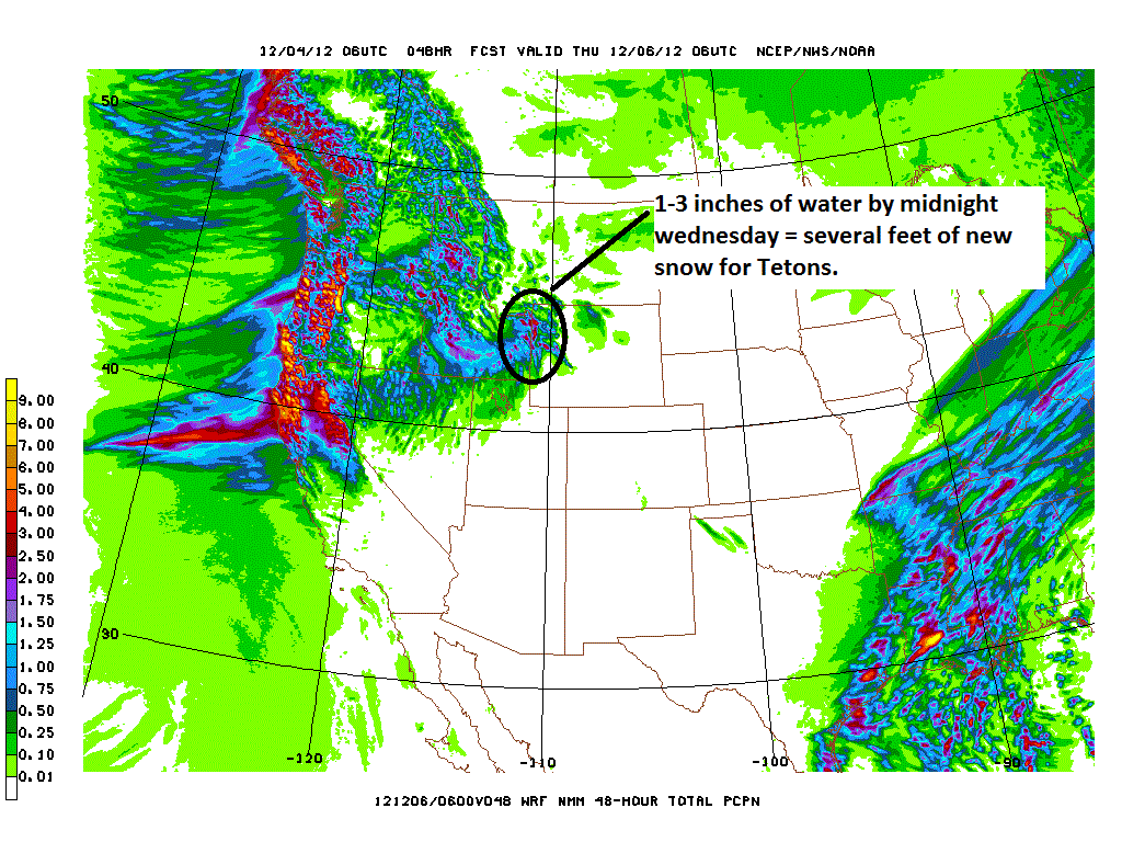
Another 1-3 feet should fall from the latest impulse by sometime wednesday and then another stronger wave will move in later in the week with similar robust totals.
On the east coast, we’ll generally see above seasonal temps as the aforementioned low deepens to our west/northwestand tracks to our north. The flow around the low will pump warm and humid air into the region with a brief, but much appreciated break tusday night into wednesday. At that time a little transient trough of cold air will slide through. The dynamics of the front look promising for a rain to snow event that produces a few inches of snow along the favored higher terrain of NY, VT and NH.
In the wake of the front a cool northwest flow will developed. Modeled data suggests we’ll have favorable conditions for orographic snowfall wednesday into thursday.
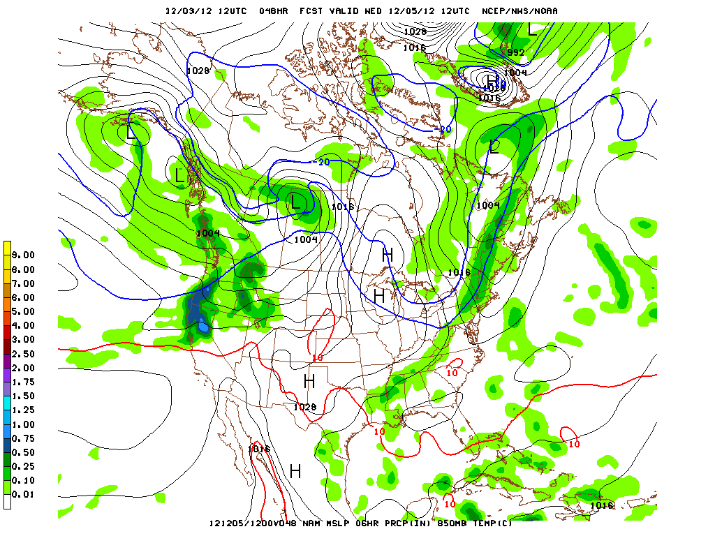
Esp. as the associated -10c isotherm pushes thru Wed. am…
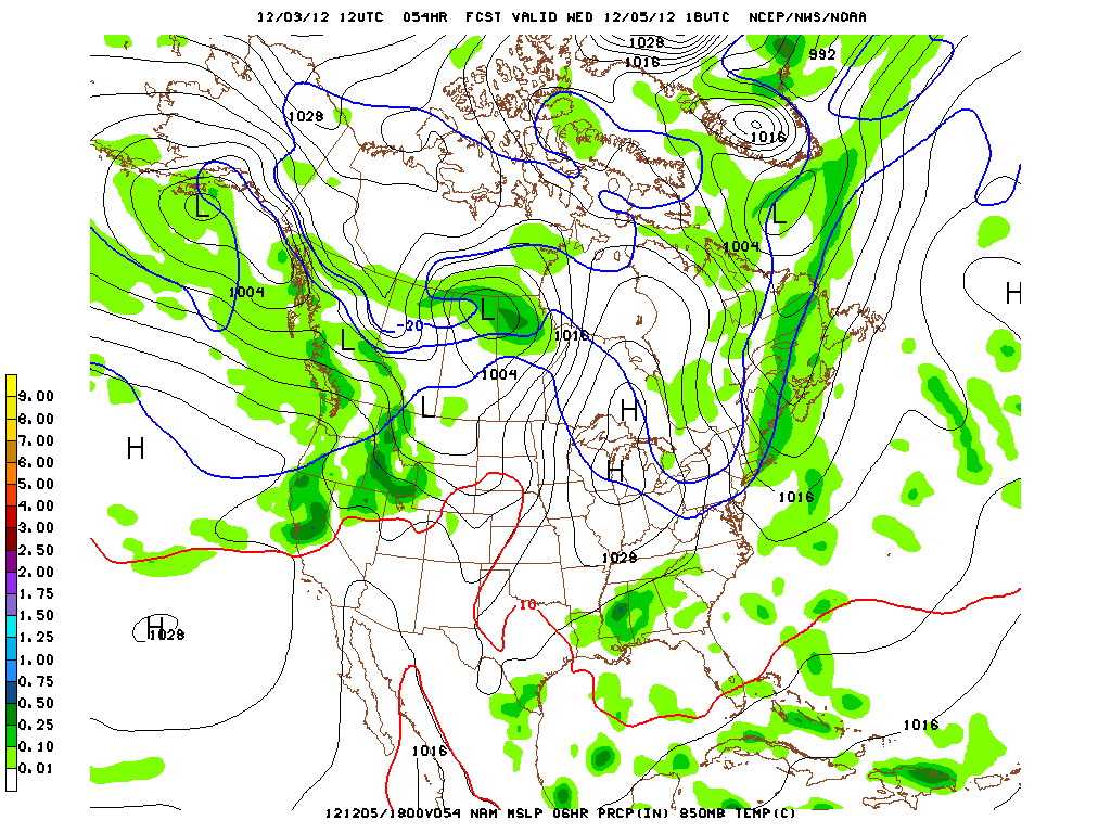
At that point we’ll really see the dentrites develop and the snow that falls should be nice and fluffy.
We’re too far out to pull the usable high-res model QPF data. But when we get closer I’ll put it up. I’d say another few inches are possible from the period of “upslope snow.”
There is some real confusion beyond this little trough. The Climate predicion center has the AO going negative, the NAO going negative and trending towards neutral over the next 14 days while the PNA goes positive. That would overall support below average temps and more cold storminess in the EC. However, the models are now showing a warmer pattern with the mean storm track to our northwest, keeping the EC in the warm sector. That just doesn’t match up to me. So I’m throwing all the model data out if it extends beyond 12/10 right now.
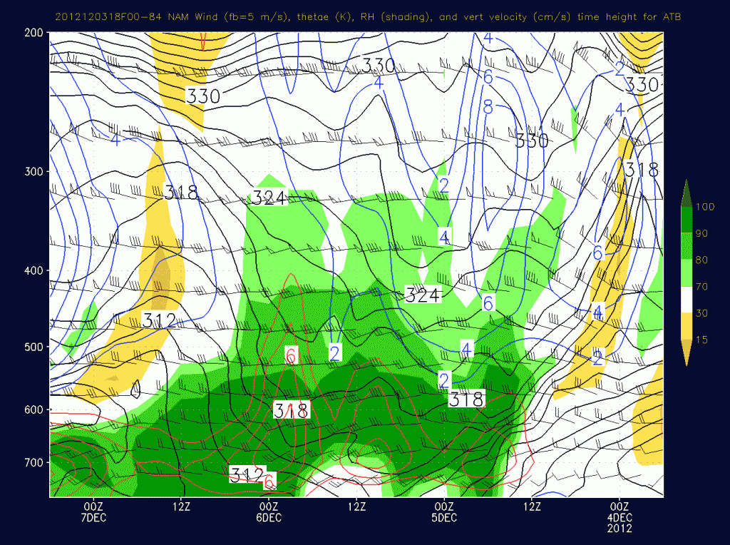
Out west, aside from the “take-a-number” deli line of storms for the PACNW, the pattern will feature a rather moist southwest flow. While the main action will be to the north, Utah will see a weak cold front drape across the region tuesday and with a stronger cold front on wednesday night thursday. The latter event is beginning to get interesting. Time height data shows not just a robust front (like the one UT just saw Sun-Mon) but also a period of sustained orographic lift as a moist west/northwest flow develops:
Were that to happen the front would go from a 4-8 event to a 8-14 type event for the Cottonwoods pretty quicky. Forecast confidence is pretty low on this system right now, but it’s growing. It was progged to stay north last week but has steadily dropped through UT for a few model runs now. I’ll watch it for another 24 hours before I say anything more.
7 Comments
Leave a Reply
|
|||
| Home |





Greg
wrote on December 4th, 2012 at 9:06 amNot to be too persnickety (but I will be) when you say that the associate -20c isotherm comes through on weds AM, do you mean actually Thursday AM?
Lionel Hutz
wrote on December 4th, 2012 at 9:46 amNope. -10c isotherm is what I mean. In the model image posted we see the location of the 0c and -10c isotherms for the 850mb pressure level. That image is valid at 18z Wed. the -10c isotherm is south of the area. The movement of air modeled would indicate that the -10c isotherm moved through before 18z. Like between 12z (7am) and 17z(noon) on wednesday.
Ultrajamzilla
wrote on December 4th, 2012 at 3:05 pmHey Lionel, thanks for the continued efforts. Any chance we NH riders could get a little White Mountain love on your update for later this week? Cannon Mountain is the place, Id like to know the time.
You rule.
mtl_ripper
wrote on December 5th, 2012 at 11:36 amhoping for winter without having to take an airplane. The irony of it, in a carbon warming sense…
Matt
wrote on December 5th, 2012 at 8:20 pmWill any of that snow make it to Colorado?
CO Guy
wrote on December 7th, 2012 at 1:11 amDefinitely wondering this myself.
mtl_ripper
wrote on December 10th, 2012 at 11:07 amlook North for snow, O Easterners.