Weather Blather: Light Upper Elevation Snow possible
By: Lionel Hutz
March 30, 2010 7:41 am | Category: Weather
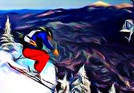
Just taking a quick look at the weather this morning and wanted to take a minute to point out the chance for upper elevation snows in VT over the next 24 hours.
As a storm system hammers the coast with rain some cold air will work into Northern Vermont. At the same time, some moisture will be pushed into the area. With a freezing level around 2700 -3000 feet I suspect to see some light snow at the higher elevations. Total accums should be in the area of 2-5 inches in the Mansfield region with 1-3 further south along the spine (and with a slightly higher freezing level).
Tags:
Weather
4 Comments
Leave a Reply
|
|||
| Home |


powhounddd
wrote on March 30th, 2010 at 7:47 amThanks for the weather heads-up LH. I was just beginning to wonder when you’d give us hope yet again!!
Greg
wrote on March 30th, 2010 at 10:34 amthanks dude… maybe i’ll get a pow day tomorrow!(?)
Josh Bushwacker
wrote on March 30th, 2010 at 10:24 pmFYI was rain to the top of lifts today on manny. dont know what tomorrow holds but that was the case today.
Lionel Hutz
wrote on March 31st, 2010 at 9:23 amYea…looks like the atmosphere didn’t cool as it was forecast to do. It was going to be close anyway. I’d still suggest somebody check the highest terrain as surprises on east facing slopes are certainly possible.