(UPDATED 4/3/10) Weather Blather (Cottonwoods Edition): Another punch of snow likely
Currently, if you live in the vicinity of the Cottonwoods you are waiting either in the Collins lift-line in which case – “are you are quad?” or on the road up the canyon. When you get to your destination however, I suspect the wait will have been worth it, as the exiting system delivered as forecast. A solid 24 with pockets of higher along west facing slopes in 38 hours. Not bad. Sounds like a good time for some phatties. At a solid 8-12% it will also stick around as the winds pick up in advance of the next system. However, with the dust below the new snow and various sun crusts be careful! Check the Avy forecast and MAKE SURE to wear your beacons. I don’t have that many readers so I can’t go around letting you all get buried.
As for the next system….
4/2/10 Update:
Currently, 3-4 inches has fallen since 3:00 am MST with another 4-6 on the way. Looks like the heaviest snow will be confined to the Northern Wasatch (North of I-80). However I’d say a still a solid 8/9 inches are possible be the end of the afternoon in the Cottonwoods. Not bad. Another weak impulse will swing through tonight and prob. drop a light 2-4 inches of surface dust just to bump 24 hr snow totals to around a foot.
As a note towards next week, it looks like another rather robust snow event Monday into Tuesday night as a deep pacific trough moves into the area and an unstable NW flow develops. Stay tuned on that.
OLDER STUFF
As we speak, dry air is moving in from the SW and shutting down any persistent instability across the Wasatch Range. With rising heights over the next 12-18 hours and the aforementioned air advection, I’d expect to see a bluebird afternoon of powder schralping similar to Last Friday afternoon.
However, the “nice” weather will be broken by evening, as another Pacific trough moves into the region. Currently, as seen clearly in this Sat Image the moist system is over Oregon and Washington with a cold front extending down into NorCal.
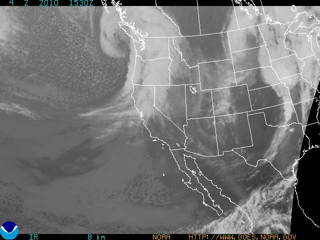
As an aside, the darker/clearer air over NV/AZ/Cali is the drier air I mentioned above. (There I go, giving away the keys to the kingdom).
By early Sat. AM the system will have moved SE and the front will be just entering UT with several embedded nuggets of vorticity.
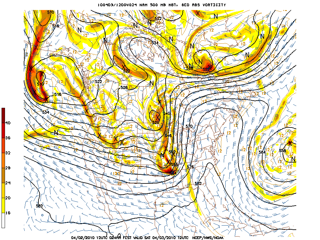
Ahead of the system precip should spread into Northern 1/2 of the Wasatch Range. The NAM does a good job picking this up and I’m inclined to use the NAM guidance here as I think it does a decent job for UT on timing/coverage of precip.
Precip spreading into region ’round midnight

Remaining steady into the morning
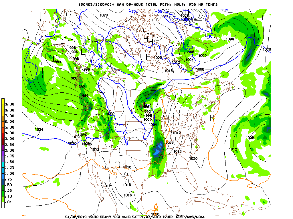
By the afternoon, the snow will be primarily orographic in nature and confined to the slopes of the Wasatch range. With the heaviest snow falling along west/northwest facing slopes of the Central Wasatch (Cottonwoods).
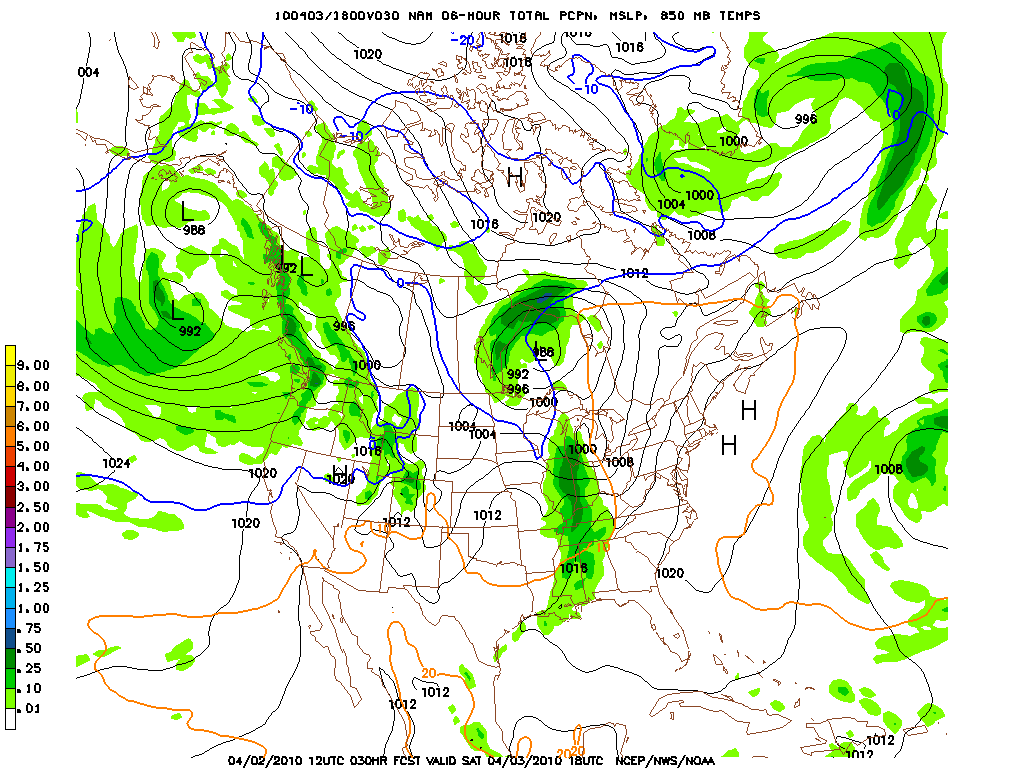
By late Saturday, while the larger models indicate the snow will taper off, the high res models and several data runs do indicate that conditions will be favorable for at least on and off orographicly enhanced snow showers along the West/Northwest facing slopes as a fairly moist air-mass with moderate instability will persist.
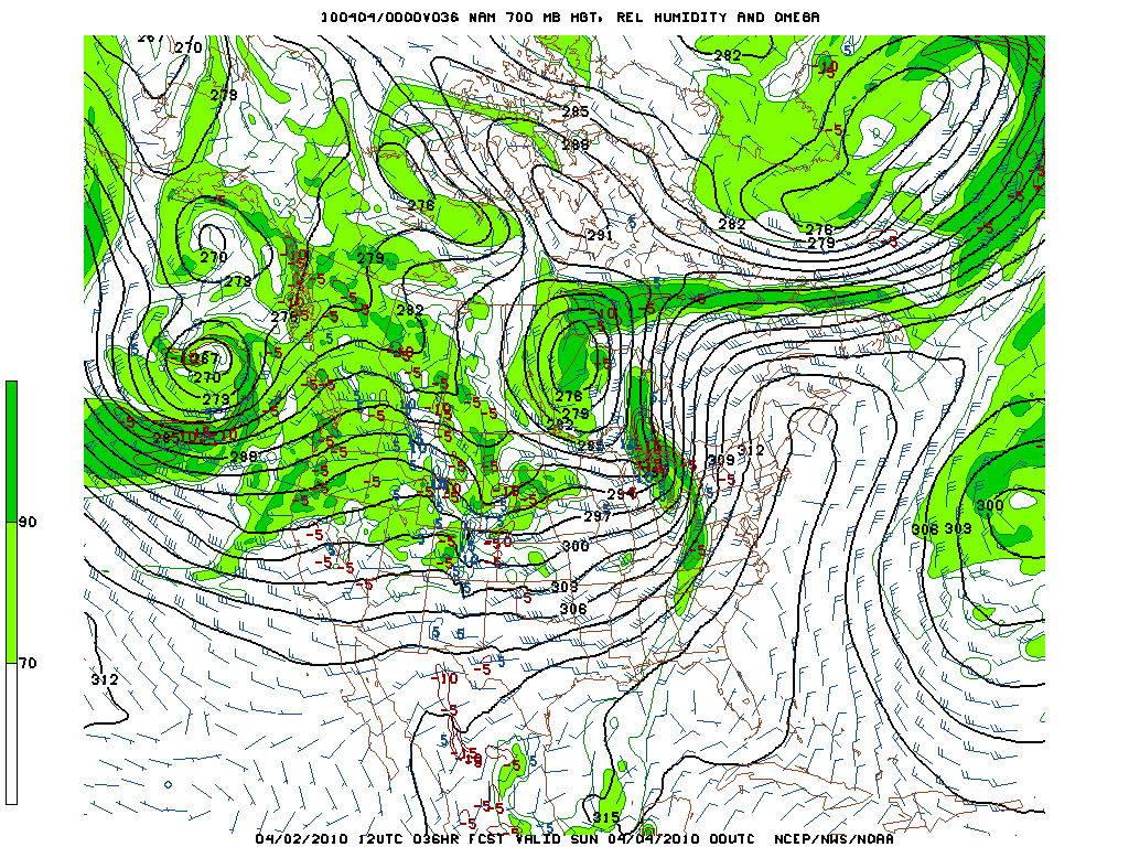
If the winds align right we could see these showers get pretty robust and add a decent chuck of snow to the system. Tough call on this period.
Overall QPF model output looks a little too wet for me:
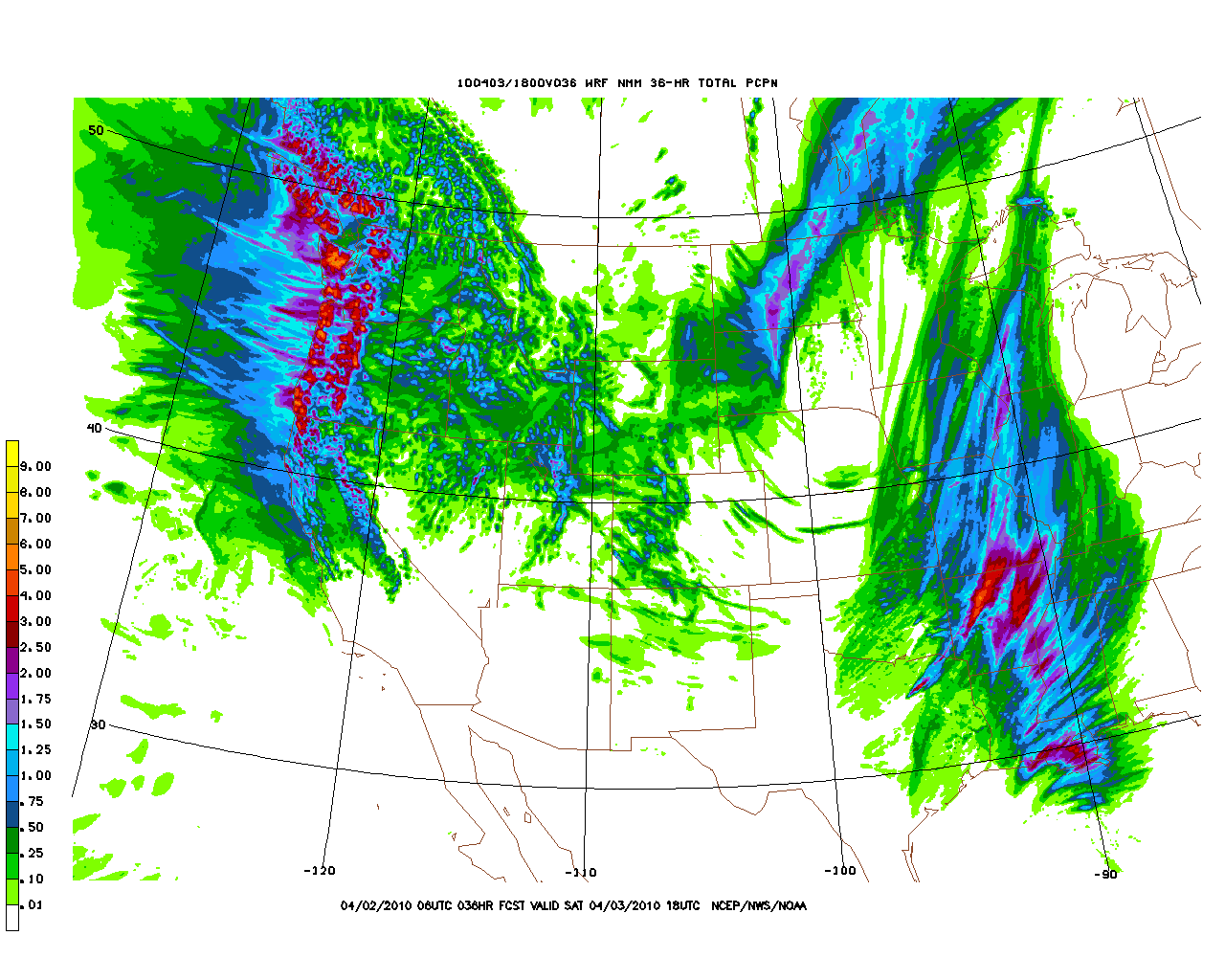
I think 1.75 of water is too much for the system. I don’t see the instablity/duration necessary to squeeze that much water out. However, I think as a MAX if everything works just right that number is pretty reasonable. Personally I’d expect something like 8-16 inches by midday Saturday with the higher numbers (or more) coming if we get good shower activity Saturday afternoon.
K ThX BAi.
Leave a Reply
|
|||
| Home |


