
I came across a pretty cool tutorial the other day after seeing a tip on TGR. So I just started playing around with some old pictures, and came up with something I think looks pretty fun. I’ll be trying some more of these in the next few weeks and posting them here.

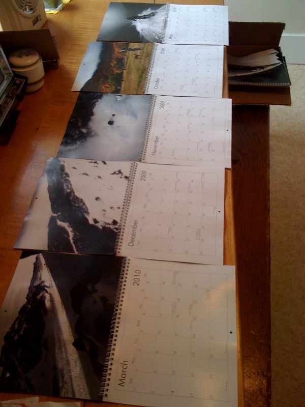
The calendars are here and look great!
Click on the picture to check them out:
Types of Storms We See: The Alberta Clipper
Before we get into ski season I figure the best thing to do is to introduce you all to some of the ways we get snow. Partly I’m doing this so that you all can understand what the hell i’m talking about and partly I’m doing this because I don’t want to bill any more hours today.
Now not every snowfall we see is because of a classifiable storm. Sometimes it just snows…but really, more often than not, one of the following types of events produced our snow. So without further delay let me introduce you all to the basic types of snow events we get. They are in some particular order:
1. The Alberta Clipper
2. The Great Lakes Cutter (BOOOOOO)
3. The Nor’Easter
4. Lake Effect
5. The “wraparound”
6. The FREAK
Alberta Clippers are generallyquick moving, small, low pressure systems which originate in – wait for it- Alberta Canada. As they are born from energy in a cold, dry region of the country they usually contain little moisture and little dynamic lift. As a consequence they often produce small snowfalls.
Clipper systems, once borne generally take several paths. They head straight across the Great Lakes, they swing south and head along I-80 and pop out over Long Island or they swing further south and hit Baltimore/Washington area. Storms that travel across the country further than that are generally not considered clipper systems as their origins are likely more southerly latitudes – like the four corners regions of the west.
)
Typically you’ll see 1-3 inches of snow at lower elevations and in the big cities with a clipper system and 4-8 inches of snow in the mountains.
Now don’t start thinking that clippers are boring. In fact they are far from boring. Personally I think that are the second most important weather system for east coast skiers. Why? Well several reasons. First- they are more common. I know we love skiing after a big dump but honestly we need these regular systems to freshen up surfaces, build bases and the like. Second, I love clipper storms because they have the potential to just blow the fuck up (in a good way).
)
See clipper storms have a cold heart. They generally move through the northeast when it’s cold and usually just pass off into the cold ocean.
)
But every so often that doesn’t happen. Sometimes we get lucky and the clipper catches some of the southern jet stream energy. When this happens warm air is pulled up and over the cold core to the north of the low, as the low strenghens from the interaction of the cold and warm air, the snow really begins to pick up…If you live in the catskills, central VT, or Western Mass- this is your shit.
The next picture shows the enhanced snowfall potential when a clipper starts to draw warm air in from the south
)
But that’s not all. If we’re really really lucky something truly magical happens…instead of interacting with the southern energy over land, the clipper pops off the coast and interacts with the southern stream energy over the ocean. Now, not only is warm air being pulled into the deepening low, but moist ocean air too boot. The result is a low that is now pulling in artic air from the north and warm moist air from the south. To anybody who knows anything about weather this is the recipe for BIG N/E coastal storms. Depending on the track of the low you can see heavy snow anywhere in ski country!
)
)
Introducing the new weather section
Just in time for the Fourth of July holiday weekend, FamousInternetSkiers.com is launching our new weather dashboard! We’ve teamed up with Lionel Hutz (of TGR-weather-forecasting-fame) to give you a single stop to catch up on all the eastern weather related information that, in the past, you had to run all over the internet to gather. We’ve got two radar views, webcams, current conditions at those NWS sites you are always checking (Mt. Wash., Stowe, and Saranac Lake), northeastern US satellite imagery and…
Lionel will be running a blog on the weather page which he will update “stormly”, or in other words, whenever a storm is coming down the pike. He may also make updates prior to big holiday weekends… indeed he was kind enough to put up a post outlining his thoughts for the weather this Fourth of July (and Canada Day) holiday weekend to give you an idea of what to expect. Here’s his latest map:
)
Also, he went back into his archives and agreed to post up a few of his weather discussions from this past winter to prove how awesome he is at this stuff (he predicted that sequence of storms in February when it wouldn’t stop snowing). Enjoy and please don’t hesitate to chime in with your comments and suggestions. And if you see any bugs or browser issues definitely please drop us a line.
Sorry for those of you who are subscribed to the site via RSS and had to bear with us as we tested the blogging feature on the new weather page, and saw a stream of nonsense posts. HOWEVER… to those of you who aren’t subscribed to the site via RSS, what better time to sign up than today? Not only will you automatically get fed all the latest ski porn (we’ll be adding a bunch of old TRs and never-before-seen photos throughout the summer), but you’ll also get Lionel’s weather discussions delivered to your RSS viewer.
If you’d like to support the new weather page please consider purchasing a calendar.
We’re going throw a little map up here today to see if we can get this nailed down.
So what a better way to test our new click-y thumbnail awesome-nicity than with a weather update for one of the best days of the year- the 4th of July!
I’ll be short. If you live on the east coast it will be one of the nicer days all summer. Temps between the mid 70’s to Mid 80’s with relatively dry air moving in form a nice northwest flow.
Normally at this time of the year we don’t get a northwest flow. Normally we get a flow of air from the Southeast U.S. Which is hot, and humid. Air from the northwest on the other hand tends to be drier and cooler…you know since it comes from central canada which is cool and…ummm..lacking a warm ocean.
If you live further inland…well you’ll see more clouds and scattered rain showers but they should be light (with the exception of a mid day burst in the ADK).
Click on the Map below to see what I’m blabbering about:

-
Search
New Comments
Surfing Safari on Burlington's Booth Street | Seven Days said: “[…] lights and snapped away. Here’s a...(read more)” about Surfing the Flood
macbook repair seattle said: “macbook repair seattle Let’s get it started...(read more)” about Let’s get it started
Greg said: “Thanks for all this great info. And...(read more)” about Skiing Mt. Colden’s Trap Dike
Greg said: “Definitely late, but always welcome!” about Skiing Mt. Colden’s Trap Dike
Bob said: “[* Shield Security plugin marked this comment...(read more)” about Skiing Mt. Colden’s Trap Dike
Regular paint Maintenance said: “Regular paint Maintenance Behind The Schuss(ic) :...(read more)” about Behind The Schuss(ic)
The 2012-13 Ski Season in Photos #13 | NY Ski Blog said: “[…] tweeting about big Memorial Day snow...(read more)” about pow
ml242 said: “LuckyLuc and MadPat on the same day?...(read more)” about Deep Cover Anthropology
Twitter Feed
-
Categories
- Skiing (438)
- Weather (188)
- WTF (5)
- Quick Update (173)
- Full Trip Report (165)
- WebiGNARs (45)
- General Interest (38)
- Site News (27)
- Summer (59)
- Hiking (26)
- Swimming (15)
- Climbing (13)
- Longboarding (3)
- Whitewater Kayaking (2)
- Mountain Biking (1)
- SPA (16)
- Gear Review (8)
-
Archive
- October 2018
- June 2017
- November 2016
- October 2016
- March 2016
- January 2016
- October 2015
- February 2015
- January 2015
- December 2014
- November 2014
- October 2014
- September 2014
- July 2014
- April 2014
- March 2014
- February 2014
- January 2014
- December 2013
- November 2013
- October 2013
- September 2013
- August 2013
- June 2013
- May 2013
- April 2013
- March 2013
- February 2013
- January 2013
- December 2012
- November 2012
- October 2012
- September 2012
- August 2012
- July 2012
- June 2012
- May 2012
- April 2012
- March 2012
- February 2012
- January 2012
- December 2011
- November 2011
- October 2011
- September 2011
- August 2011
- July 2011
- June 2011
- May 2011
- April 2011
- March 2011
- February 2011
- January 2011
- December 2010
- November 2010
- October 2010
- September 2010
- August 2010
- July 2010
- June 2010
- May 2010
- April 2010
- March 2010
- February 2010
- January 2010
- December 2009
- November 2009
- October 2009
- September 2009
- August 2009
- July 2009
- June 2009
- April 2009
- March 2009
- February 2009
- January 2009
- December 2008
- November 2008
- October 2008
- April 2008
- March 2008
- February 2008
-
Friends of F.I.S.

About Us:
We are a group of powder hungry, east-coast-bred, world-traveling skiers and riders who Earn Our Turns to bring you the best stoke a click-of-the-mouse can buy.We hope our adventures inspire you to Earn Your Turns as well!
LEARN MORE

Latest Weather
When one makes meatballs, one must begin with quality meats: ...
Read more in: Meatballs! (read more)