
I was going to wait until tomorrow’s GFS came out but since there is bitching going on I’ll just post this now
Wed AM weather Update:
Friday Event
On Monday I posted two GFS maps which showed a Low pressure system traveling up towards the lakes and then flattening out and traveling due east across NY State and Mass. This is an abnormal storm track but is caused because of the large flat High pressure situated in southern Canada. The storm simply cant cut into that and will instead ride along the boundary of the high.
See Here:
Tuesday the GFS advanced this theory even further. It took the Low on a normal great lakes cutter path, then had the High pressure kill it. It then took the remnants of that Low and streamed them along the frontal boundary that will be draped over us all week. This creates a very nice snow for areas north of the catskills or maybe Kmart.
See Here:
Now I rather like this solution. That H in Canada isn’t going anywhere and neither is that front. If the L can’t plow through the H it has to go around it.
Now Today’s (WED) GFS….
Also worth considering are three factors:
1. Cold snow pack all the way south through the great plains and Ohio valley. It’s been cold there and that will help to reduce the temperature of the air that begins streaming north into the system
2. The cutter doesn’t start out as a monster. That’s good because the bigger it is IMO the more likely it is to pull tropical moisture and air up into it. We want some moisture but not a fucking monsoon. We don’t have the cold High pressure to support that baby.
3. The pattern in general favors this solution.
So what does my gut tell me? Well first it tells me don’t go crazy one way or the other. This winter hasn’t followed form, there have been extremes all over the place. Second it says make the weather prove to you it changed before you forecast it to change. In November the pattern was cold with storms being suppressed to the south and east. Now the pattern appears to be a e-w pattern were moisture travels along a front. Put 2+2 and you get a set up for a nice little storm from the Catskills north. Right now it’s really too early to tell what amts would be but I’ll go out on a limb for you all and say 6-8 in favored areas seems pretty reasonable with maybe a few inches more or maybe a few inches less as sleet mixes in.
(as an aside- just after I wrote this Elliott Abrams posted this: But then, the numerical models show a pattern change. Instead of taking the storm northeastward to bring rain to places like Boston and Portland, they suggest the midwest storm will weaken as a new storm forms south of New England and then moves almost straight east. If this happens, central and northern new England will get heavy snow because the warm air will not be able to reach that area.) Now I don’t love EA but at least you know I’m not crazy.
Sunday/Monday Event
Now we’re just at the edge of GFS fantasy land here but since we’re getting close to the holiday period I’ll just show you what I see.
Yesterday (Tuesday) GFS:
First we see a Low pressure starting to take shape and begin tracking towards the Great Lakes. Stop me if you’ve heard this before.
As the Low tracks N/E however the moisture and energy begins to break off and move more east. This should perk up your ears because this indicates possible development along the coast of Delmarva/NJ which as we all know can be boner creating.
See Here:
See the moisture and the energy beginning to stream along the front
Fuckin’ funny. What does the next frame show? A secondary low forming off of N.J.
What’s super key to here is how soon that second L forms and takes over is key. We want the transfer to be fast and soon. The later the shift happens – the more warm air gets pulled north by the primary low cutting into the lakes and the more north the secondary low tends to form. Here the GFS doesn’t have a huge slug of warm air shooting north but this is IMO the least predictable storm pattern so don’t put your 401k on that GFS prediction.
Now the last slide shows a moderate L pressure right over NYC ( a little northwest for my tastes- I prefer montauk) pulling a moderate amount of moisture in off the ocean and dropping it in the form of snow over the mountains.
See here:
Will this happen…who knows. I really really don’t like the double L transfer pattern. I think the models overplay the transfer and we’ve been burned in the past with these storms. Ergo I will reserve judgment on this thing until later in the week.
Laters.
These are the maps I like to make
I like making maps out of maps. You can’t get this quality anywhere else!
)
And we make ghetto as snow maps!
)
I mean where else can you get that shit?
exactly.
Welcome to Lionelhutz’s Ski Weather Blog!!
Wow. First let me thank Allen, Sam and Greg for letting me spout off about the weather on their site. They take sick pictures, ski sick lines and are way too cool to associate with a guy like me in real life. In fact, I’m probably the guy they make fun of at the bar after a day in the B.C. Thank god for the inter-webs!
I guess I should tell you a little about myself. I’m not a meteorologist. I’m an attorney and a huge weather fan. I love it. Ever since I predicted the March 1993 Super Storm to my dad and won a large Roy Roger’s French Fry (Pouring one out for my man Roy right now) I’ve been watching winter weather.
After Ms. Hutz introduced me to skiing, I’ve become even more obsessed with winter weather. I live for it and love to share my knowledge with others. My goal, as some of you may know, is to to put good skiers in the way of the best storms.
If you followed me on TGR you know what you to expect. If you are new, check out some samples I did last year in the archive section. If there’s something “brewing” you can be sure I’m talking about it. If you just stumbled on this site to find out what the weather will be at Okemo for your family vacation well- a) look at accuweather and b) grow a pair and ski somewhere good. Quit being a bitch.
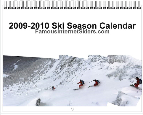
The calendar has been finalized and is now available for ordering. The calendar features 13 original images, and in addition to all the standard holidays, we have added a few “special dates” skiers should know about.
Check out the final proofs here. Order now for $24.99 $15.99 plus shipping. If you need shipping outside the United States please contact us.
Click on the picture to check it out:
TR: Dodge’s, Empress, Dutchess, Sluice 4-8-08
I revisted all the shots from this classic trip report, and have brought them all up to a more professional quality thanks to new digital development skills I have acquired over the past year. Moreover, I added several extra shots that weren’t in the original trip report (including an action-mosaic from Sluice).
Enjoy the full day here:


-
Search
New Comments
Surfing Safari on Burlington's Booth Street | Seven Days said: “[…] lights and snapped away. Here’s a...(read more)” about Surfing the Flood
macbook repair seattle said: “macbook repair seattle Let’s get it started...(read more)” about Let’s get it started
Greg said: “Thanks for all this great info. And...(read more)” about Skiing Mt. Colden’s Trap Dike
Greg said: “Definitely late, but always welcome!” about Skiing Mt. Colden’s Trap Dike
Bob said: “[* Shield Security plugin marked this comment...(read more)” about Skiing Mt. Colden’s Trap Dike
Regular paint Maintenance said: “Regular paint Maintenance Behind The Schuss(ic) :...(read more)” about Behind The Schuss(ic)
The 2012-13 Ski Season in Photos #13 | NY Ski Blog said: “[…] tweeting about big Memorial Day snow...(read more)” about pow
ml242 said: “LuckyLuc and MadPat on the same day?...(read more)” about Deep Cover Anthropology
Twitter Feed
-
Categories
- Skiing (438)
- Weather (188)
- WTF (5)
- Quick Update (173)
- Full Trip Report (165)
- WebiGNARs (45)
- General Interest (38)
- Site News (27)
- Summer (59)
- Hiking (26)
- Swimming (15)
- Climbing (13)
- Longboarding (3)
- Whitewater Kayaking (2)
- Mountain Biking (1)
- SPA (16)
- Gear Review (8)
-
Archive
- October 2018
- June 2017
- November 2016
- October 2016
- March 2016
- January 2016
- October 2015
- February 2015
- January 2015
- December 2014
- November 2014
- October 2014
- September 2014
- July 2014
- April 2014
- March 2014
- February 2014
- January 2014
- December 2013
- November 2013
- October 2013
- September 2013
- August 2013
- June 2013
- May 2013
- April 2013
- March 2013
- February 2013
- January 2013
- December 2012
- November 2012
- October 2012
- September 2012
- August 2012
- July 2012
- June 2012
- May 2012
- April 2012
- March 2012
- February 2012
- January 2012
- December 2011
- November 2011
- October 2011
- September 2011
- August 2011
- July 2011
- June 2011
- May 2011
- April 2011
- March 2011
- February 2011
- January 2011
- December 2010
- November 2010
- October 2010
- September 2010
- August 2010
- July 2010
- June 2010
- May 2010
- April 2010
- March 2010
- February 2010
- January 2010
- December 2009
- November 2009
- October 2009
- September 2009
- August 2009
- July 2009
- June 2009
- April 2009
- March 2009
- February 2009
- January 2009
- December 2008
- November 2008
- October 2008
- April 2008
- March 2008
- February 2008
-
Friends of F.I.S.

About Us:
We are a group of powder hungry, east-coast-bred, world-traveling skiers and riders who Earn Our Turns to bring you the best stoke a click-of-the-mouse can buy.We hope our adventures inspire you to Earn Your Turns as well!
LEARN MORE

Latest Weather
When one makes meatballs, one must begin with quality meats: ...
Read more in: Meatballs! (read more)