
(Updated 6/26) Weekend Outlook for June 25-27
Ever have one of those days where everything just stops? I’m not talking about the “time stopped at the peak of this mountain while I watched the sun rise” way. More along the lings of “oh my god it’s only 11 am?” sort of way. If you have you know my today. Even Sam’s awesome adventure didn’t do the trick or Porter’s first excursion since this. Perhaps the weather will.
| Jump to: | Synopsis | Friday | Saturday | Sunday | Extended |
SYNOPSIS:
Similar to the last few weekends, Friday will be a gem across the entire northeast. Thursday’s cold front will clear out the humidity and bring a cool NW flow to much of the NE. Only in the far southern portions will the temps still hover in the upper 80s. The rest of the NE – from the Catskills north will bask under sunny skies with temps in the upper sixties and mid seventies. Following that, Sat will dawn clear with building clouds. A front will scrape the northern portions of the area and aside from building clouds, set off a few showers or thunderstorms. While the total rainfall amts look light the chance for a soaking shower is present to be aware.
Clearing by Sunday, the front should only leave broken clouds in its wake. With a ridge beginning to build to the South temps will nose up on Sunday but I doubt they will break out of the 70s’ across much of the north country.
| Jump to: | Synopsis | Friday | Saturday | Sunday | Extended |
FRIDAY:
Another gem!
Primary Concerns: Sunburn. Again I’m serious. We’re at the peak of the sun’s power and with little cloud cover and low humidity the UV index will be set to “lobster” levels. So wear some sun block. Maybe a hat.
Best Location: Not in front of a computer monitor. Again: Go OUTSIDE. The weather will be great all across the NE.
Best Activity: Personally Friday night might be a great time for a long evening bike ride. The long daylight hours and the low humidity will make it feel just awesome along the roads of the Northeast. Maybe go out for a paddle. The water seems to be just crossing the “ice your marbles” levels and with light winds you could have a grand ole time.
Recreational Forecast:
By Friday morning, the today is fast approaching from the west will have cleared the area.
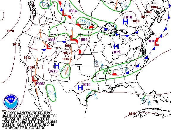
Behind the front, a vortex over Canada and building Plains ridge will force a WNW flow over the Northeast.
With Canada and the Great Lakes as a source region the air mass brought in on the NW flow will have a starkly different feel. With dewpoints in the 40’s and 50’s the air will feel bone dry.
Coupled with temps in the upper sixties to low 80s (far southern sections):
and sunny skies:
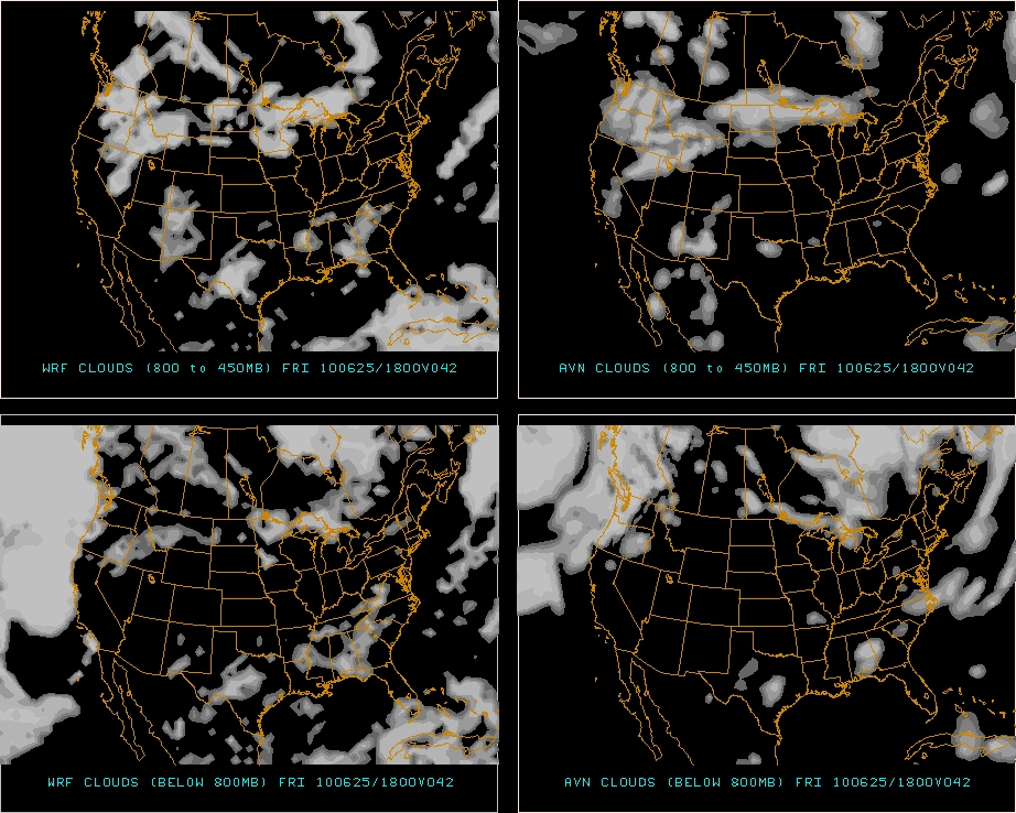
Friday will be a wonderful day to get outside.
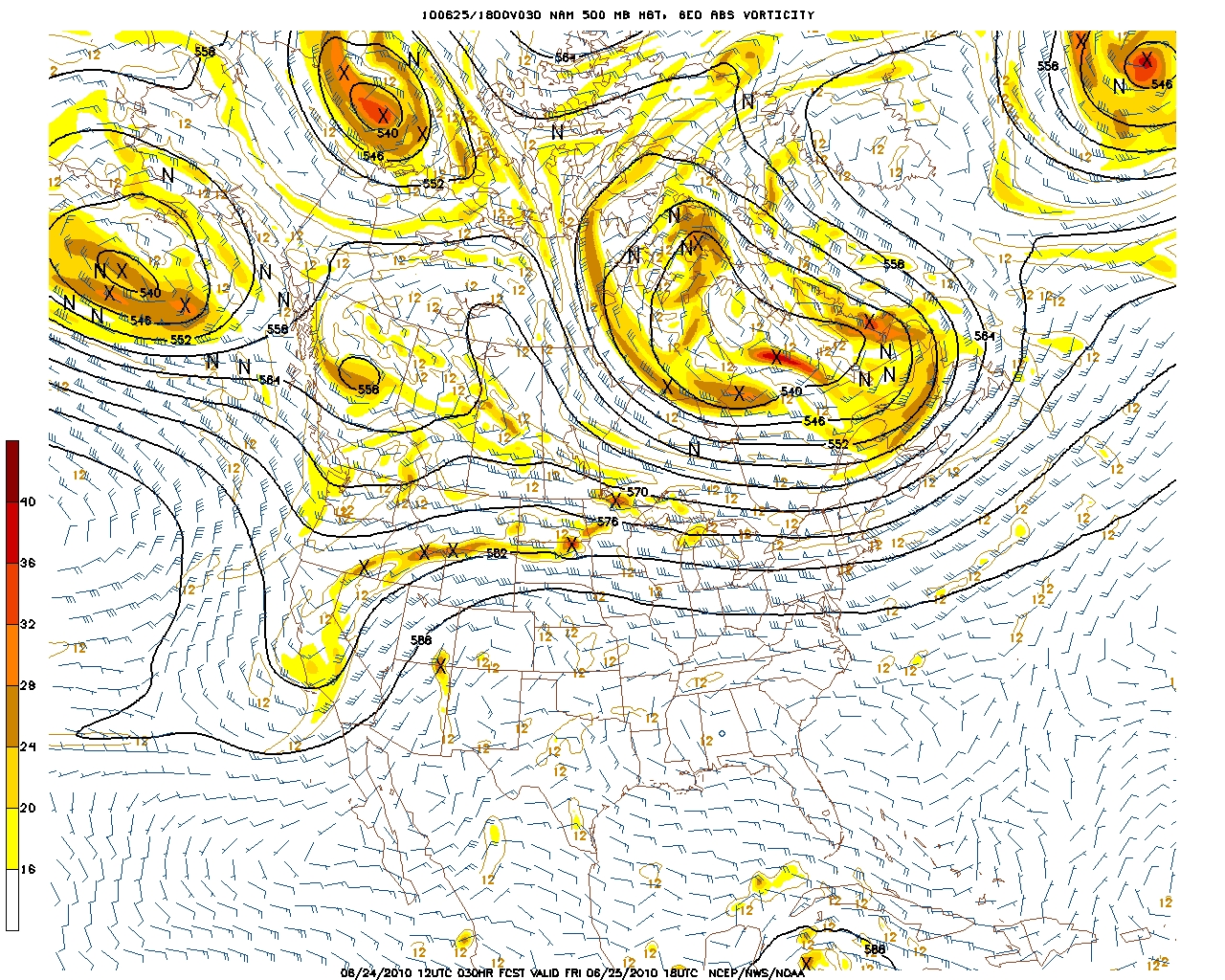
Oh- one note: I think it could get a little gusty across the Whites. If you look at the 850mb winds below:
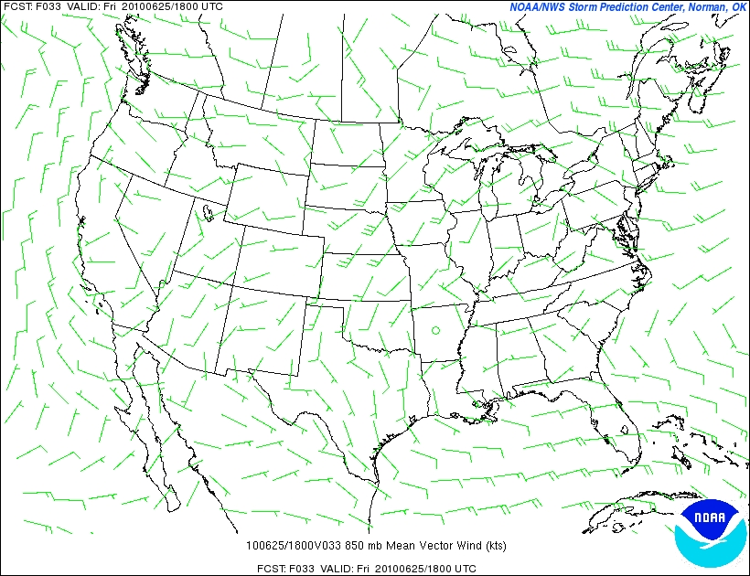
you’ll notice that the winds pick up from the Whites NE into Maine. Given the location of the vortex in Can. and the departing front, along with the ridge location in the plains, I could see some strong gusty winds along the MTW ridgelines. (What’s new right?). I wouldn’t rule out 30 mph+ gusts if this sets up right.
| Jump to: | Synopsis | Friday | Saturday | Sunday | Extended |
SATURDAY:
Saturday will dawn clear with building clouds through the day as a weak front scrapes and bounces along the northern portions of the region. As a result a round of afternoon showers and weak T-storms can’t be ruled out from the Catskills north and east. Temps will stay cool- esp. if the cloud cover builds early.
Primary Concern:
I’d say my primary concern for Saturday is an afternoon t-storm set off by the passage of a front. At this time there is some waffling in the data regarding the likelihood and strength of any such storms so I’ll just be cautious and say watch the skies from the afternoon on.
Best Areas: There isn’t one area I think that will do “best” here. I’d maybe stay to the east- NH-so the threat of showers/tstorms holds off till much later in the day.
Best Activity:
With a cool morning and low humidity, along with still below average soil moisture:
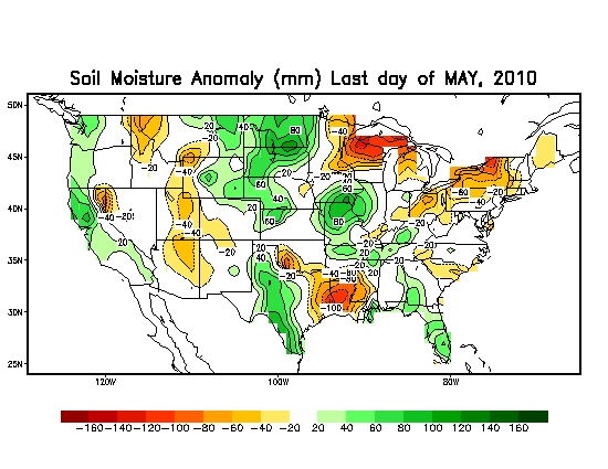
I’d say a hike Saturday morning might be very nice.
RECREATIONAL FORECAST:
By Saturday morning, the nice ridge of weather will start to be bumped by a weak front pushing down from the NW.
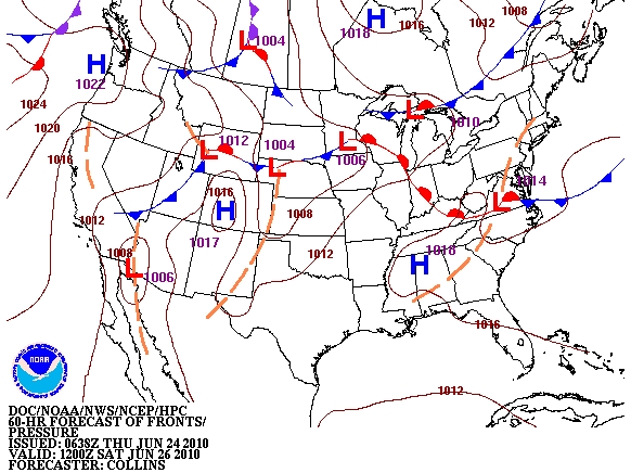
As we move into the afternoon hours, the front will push into upstate NY and VT.
Along with increased clouds (thicker over the ADK and VT)
The front should set off a few showers across the region.
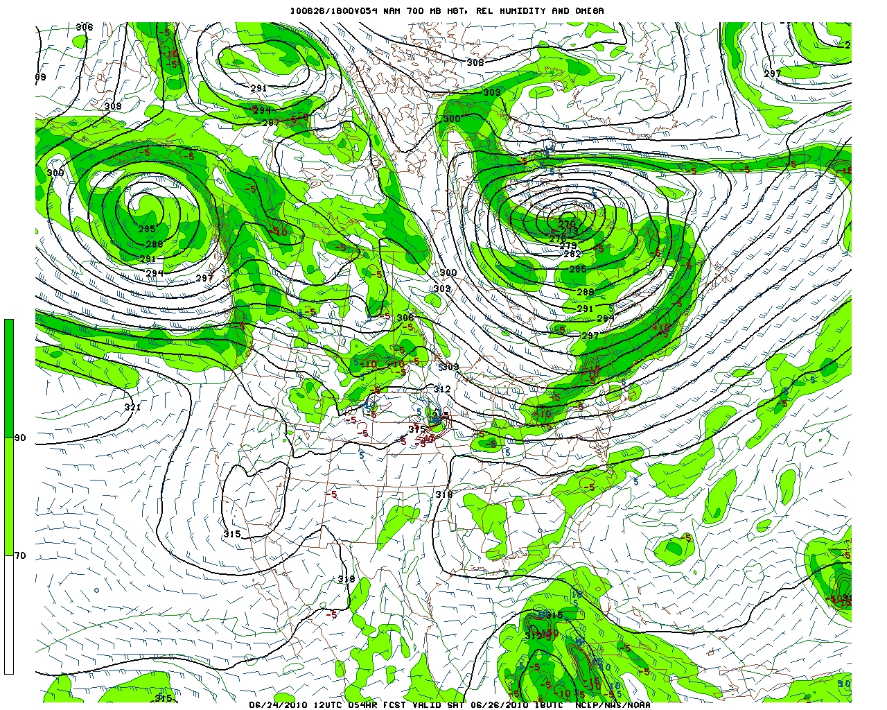
While there is a chance for T-storms, looking at the latest CAPE forecasts
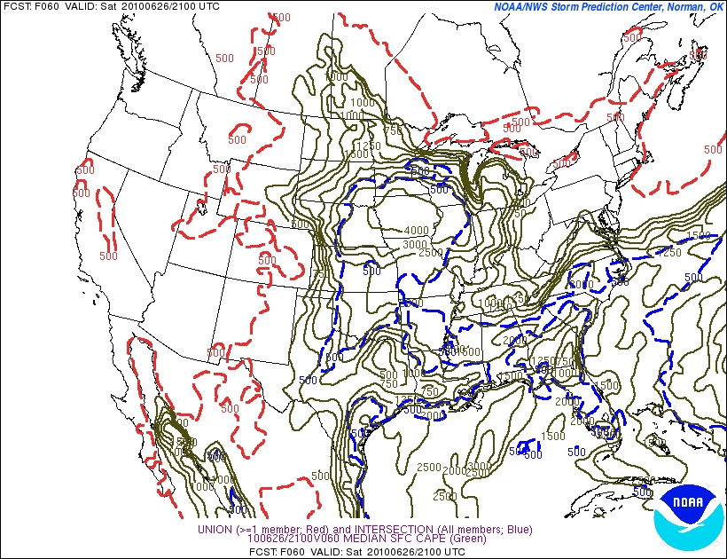
doesn’t support the conclusion that these T-storms will be damaging or severe. That doesn’t mean there is no danger however- lightning is always a MAJOR hazard in the mountains and should always be taken really seriously. Severe T-Storm or not.
Beside the front, Sat. looks to be a nice day.
The approaching front will turn the winds to the SW

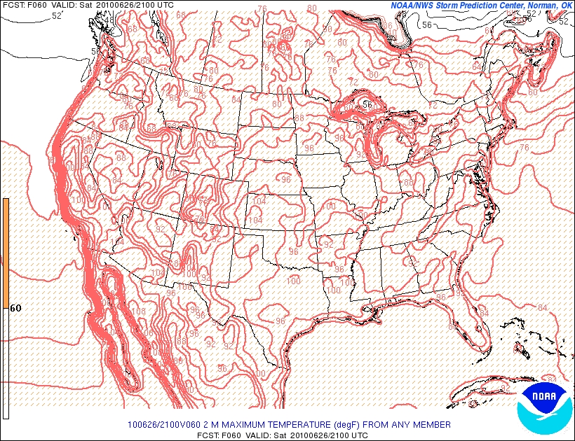
And accordingly. temps will rise into the 70’s and 80s (with a few pockets in the hills staying cooler – esp. if the cloud cover is on the thicker side).
However, surface dewpoints will stay low and thus keep it comfy.
All in all, don’t let the front get the better of you. Get out on sat. Esp. the am. Plus, there is some good data out there (with history to back it up) that this front just blows itself apart and only leads to an increase in clouds. I’ll update you regardless.
| Jump to: | Synopsis | Friday | Saturday | Sunday | Extended |
SUNDAY:
UPDATE
Looks like sunday is going to be warmer than previously predicted. I think the ADK and greens will get up into the mid 70s and have partly sunny skies after the noon hour. Prior to that I think it will be mostly cloudy with a possible lingering shower.
South in the catskills I think it will get pretty warm. Upper 80s are possible in some valleys. Sun will predominate by the afternoon. Isolated convection is also possible but most of the dynamics look to hold off until the evening.
East in to NH we’ll see conditions similar to those in the NEK.
THe further south you go the warmer it will be. The Poconos will border on downright hot.
Now, while there is some chance for an isolated T-storm all over the NE in the afternoon, the real fireworks should and most likely will hold off until the night time. With the chance for a big boy growing as we move from sunday into monday.
OLDER
Sunday should be nice day in the wake of Saturday’s front. Though rather sharply split with regards to temps/dewpoints between the north and south.
Primary Concern:
Lingering clouds enhanced by by a warm front pushing north. Possible afternoon convection along the frontal boundary
Best Areas:
Given that a warm front will push in from the south, I think the best place to be will be up in the hills where the temps and dewpoints should remain more comfortable.
RECREATIONAL FORECAST:
By Sunday, the weak cold front will have exited the region stage east. Behind it, a warm front will begin to work north. Skies should be fairly high with broken clouds in the 4-5k range.
With the warm front pushing north temps will climb into the 80’s at least as far as the southern Greens and ADK. North of there, where the front doesn’t actually look to reach, temps should remain cooler- say the low 70’s.
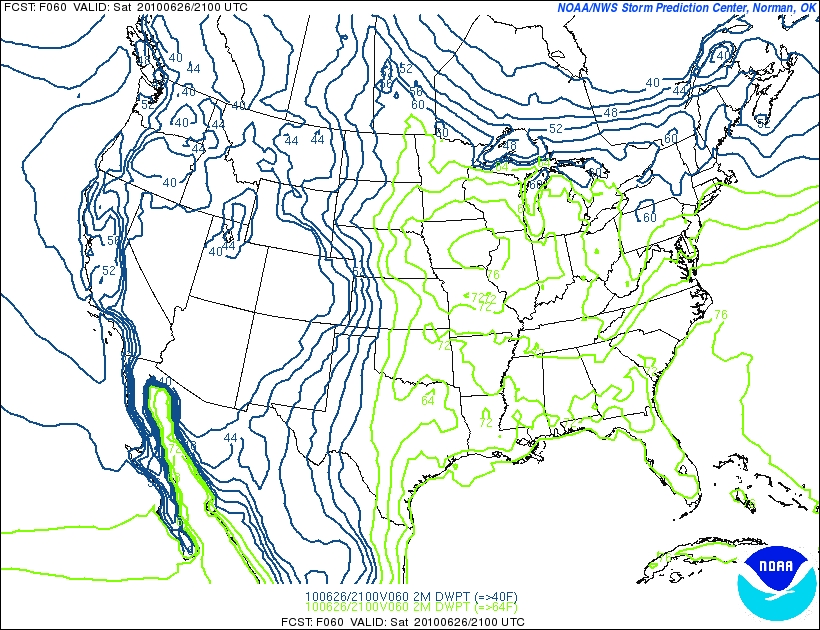
Similarly dewpoints to the south of the warm front will be in the upper 60s. North they will be in the 50s. That’s a noticeable difference.
As for precip, the warm front looks pretty dry right now though some signs point to the potential for convection on its southern edge- like say the Catskills and Berks.
I’ve held off on model maps here because I think a lot has to be worked out for Sunday. I’ll update this tomorrow once we get some better data.
| Jump to: | Synopsis | Friday | Saturday | Sunday | Extended |
Extended outlook
Monday looks like a warm unsettled day with possible strong convection later in the evening. Going to add that some of these storms on monday could get pretty wild. So be careful.
Tuesday begins a cooling trend that might last a few days.

3 Comments
Leave a Reply
|
|||
| Home |

-
Search
New Comments
Surfing Safari on Burlington's Booth Street | Seven Days said: “[…] lights and snapped away. Here’s a...(read more)” about Surfing the Flood
macbook repair seattle said: “macbook repair seattle Let’s get it started...(read more)” about Let’s get it started
Greg said: “Thanks for all this great info. And...(read more)” about Skiing Mt. Colden’s Trap Dike
Greg said: “Definitely late, but always welcome!” about Skiing Mt. Colden’s Trap Dike
Bob said: “[* Shield Security plugin marked this comment...(read more)” about Skiing Mt. Colden’s Trap Dike
Regular paint Maintenance said: “Regular paint Maintenance Behind The Schuss(ic) :...(read more)” about Behind The Schuss(ic)
The 2012-13 Ski Season in Photos #13 | NY Ski Blog said: “[…] tweeting about big Memorial Day snow...(read more)” about pow
ml242 said: “LuckyLuc and MadPat on the same day?...(read more)” about Deep Cover Anthropology
Twitter Feed
-
Categories
- Skiing (438)
- Weather (188)
- WTF (5)
- Quick Update (173)
- Full Trip Report (165)
- WebiGNARs (45)
- General Interest (38)
- Site News (27)
- Summer (59)
- Hiking (26)
- Swimming (15)
- Climbing (13)
- Longboarding (3)
- Whitewater Kayaking (2)
- Mountain Biking (1)
- SPA (16)
- Gear Review (8)
-
Archive
- October 2018
- June 2017
- November 2016
- October 2016
- March 2016
- January 2016
- October 2015
- February 2015
- January 2015
- December 2014
- November 2014
- October 2014
- September 2014
- July 2014
- April 2014
- March 2014
- February 2014
- January 2014
- December 2013
- November 2013
- October 2013
- September 2013
- August 2013
- June 2013
- May 2013
- April 2013
- March 2013
- February 2013
- January 2013
- December 2012
- November 2012
- October 2012
- September 2012
- August 2012
- July 2012
- June 2012
- May 2012
- April 2012
- March 2012
- February 2012
- January 2012
- December 2011
- November 2011
- October 2011
- September 2011
- August 2011
- July 2011
- June 2011
- May 2011
- April 2011
- March 2011
- February 2011
- January 2011
- December 2010
- November 2010
- October 2010
- September 2010
- August 2010
- July 2010
- June 2010
- May 2010
- April 2010
- March 2010
- February 2010
- January 2010
- December 2009
- November 2009
- October 2009
- September 2009
- August 2009
- July 2009
- June 2009
- April 2009
- March 2009
- February 2009
- January 2009
- December 2008
- November 2008
- October 2008
- April 2008
- March 2008
- February 2008
-
Friends of F.I.S.

About Us:
We are a group of powder hungry, east-coast-bred, world-traveling skiers and riders who Earn Our Turns to bring you the best stoke a click-of-the-mouse can buy.We hope our adventures inspire you to Earn Your Turns as well!
LEARN MORE

Latest Weather
When one makes meatballs, one must begin with quality meats: ...
Read more in: Meatballs! (read more)
Porter Haney
wrote on June 24th, 2010 at 4:00 pmDamn, Lionel. You put a lot of work into these. Great write up.
BTW to quote, the best place, is always up in the hills.
Greg
wrote on June 25th, 2010 at 8:28 amI love these Lionel. So awesome. Thank you so much. we’re gonna take a gamble and go for SPA Trip #6 on Saturday morning to the east of FIS world headquarters. World cup in the afternoon… if the front has disintegrated… sunset hike near SPA Trip #4
boardman
wrote on June 25th, 2010 at 10:19 amExcellent work, Lionel! Appreciate the effort – very useful for making the go/no-go decision on climbing. It’s a go!