
With temperature raises looming, and no meteorological will to cut a deal, the weather in the northeast left itself no option but to allow a sequester of the pow (in fog) to begin.
As the storm clouds of the imminent sequester rolled up the mountain below us, Jake was delighted by the madness. As Alfred said in The Dark Knight: Some men just like to let it fog.
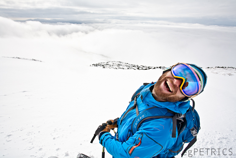
Fog baby! Fog! Bwa-haha!!
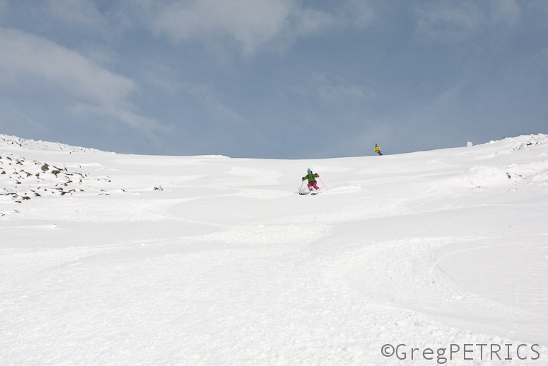
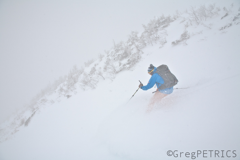
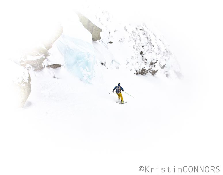
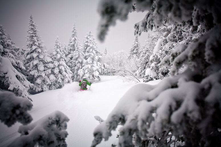
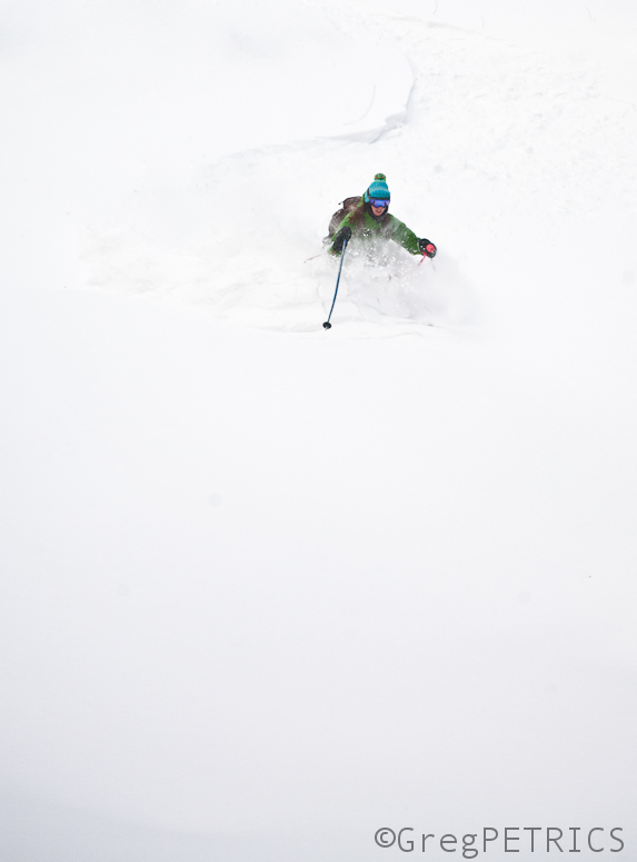
KC enjoyed a few last turns…
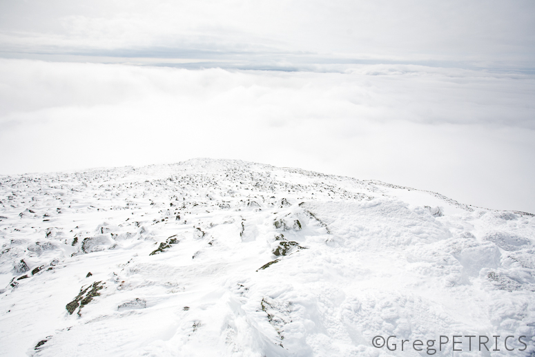
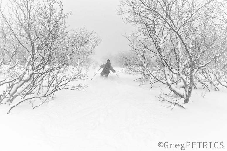
…before we plunged into the sequester.
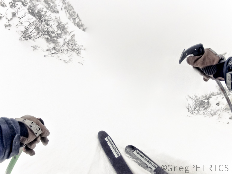
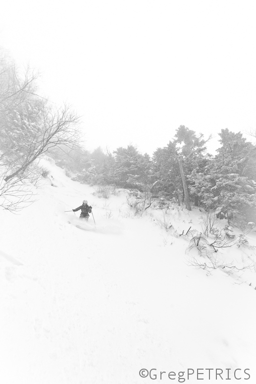
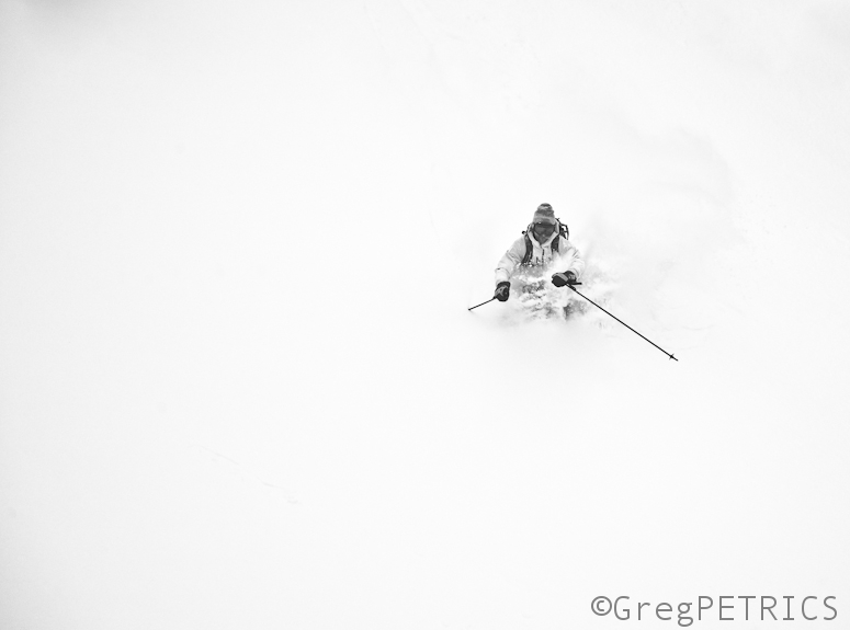
And then into the sequester we plunged! Who knows what’s ahead of us!
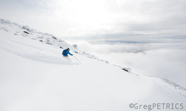
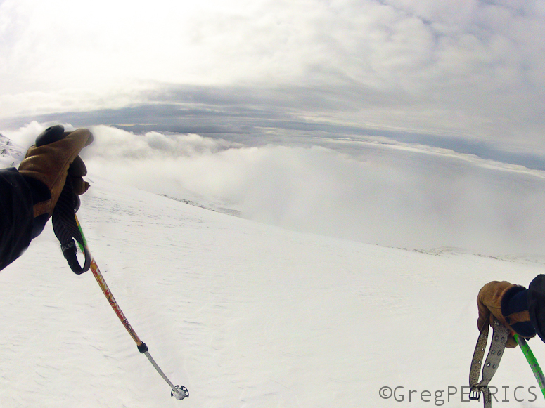
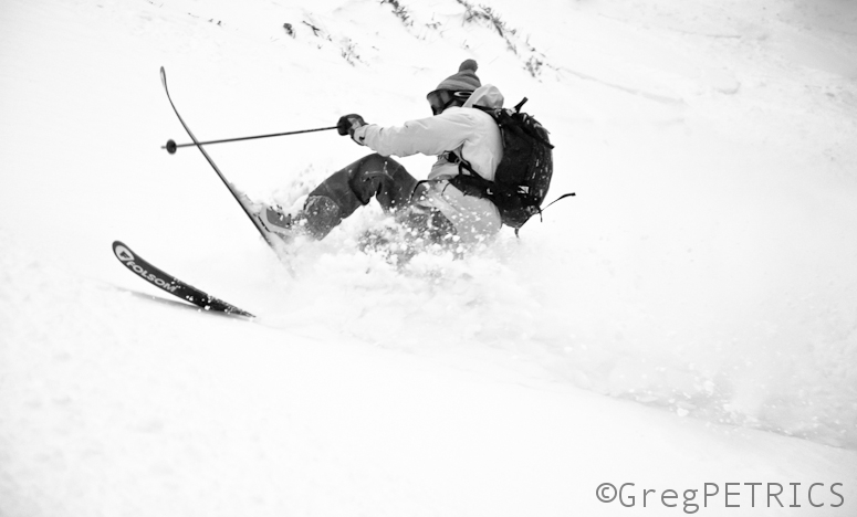
That isn’t to say there weren’t fleeting glimpses of hope though (as Lionel demonstrates here).
But the fears of the unknown were high.
It’s unclear if the weather in the northeast can reach an agreement before the temperature rises take effect (we’ll be sure to let you know if we find out), but in the meantime the sequester of the pow may actually help us. While annoying, and draining to have a near-constant sequester of the pow, just be happy that the pow is preserved, and git sum while the powers-that-be in the Holy-Zero-C° work out the details!
Upper Level Low putting the ULL in Ullr? (Update as of 1pm Tuesday)
My affection for Upper Level Lows is pretty clear. As is my love of all things pagan and norse. Lucky for me, it seems this week will combine these two loves and bring the Northeast some interesting weather.
Beginning on Wednesday, a long duration, complex, and at times, messy weather event is going to unfold over the northeast. It could be very snowy; or it could be just kinda snowy. That’s unresolved as of now. At the very least I think there is a btter than 60% chance that elevations above 2500 in the ADK, Greens and Whites come out with a net gain in the 8-12 range when all is said and done.
Let me explain.
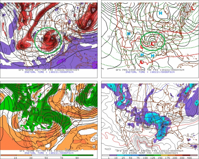
Currently a trough with a closed 500mb low is pushing out of the intermountain west.
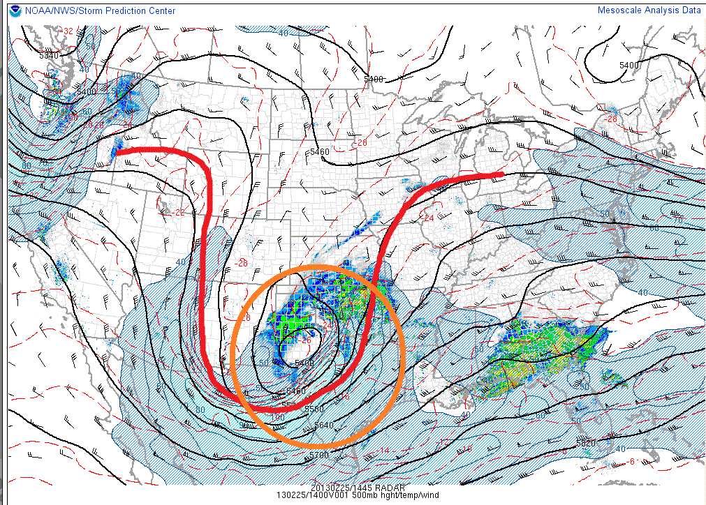
This is the same weather system that brought 20 or so inches to Utah Friday into Saturday.
As we go through the week, this is the weather system that will impact the Northeast as it moves into the center of the country, and drifts slowly east.
As we can see in the gif above, the primary center of circulation will first move northeast. The low will fully occlude (the cold front associated with the low catches the warm front) somewhere in the Ohio Valley. This occlusion will come juuuuuuuuuuuuust as the warm front associated with the low is pushing into the northeast. The low will vertically stack up (centers of low pressure at all levels of atmosphere occur on top of each other) and cut itself off from the trough moving east.
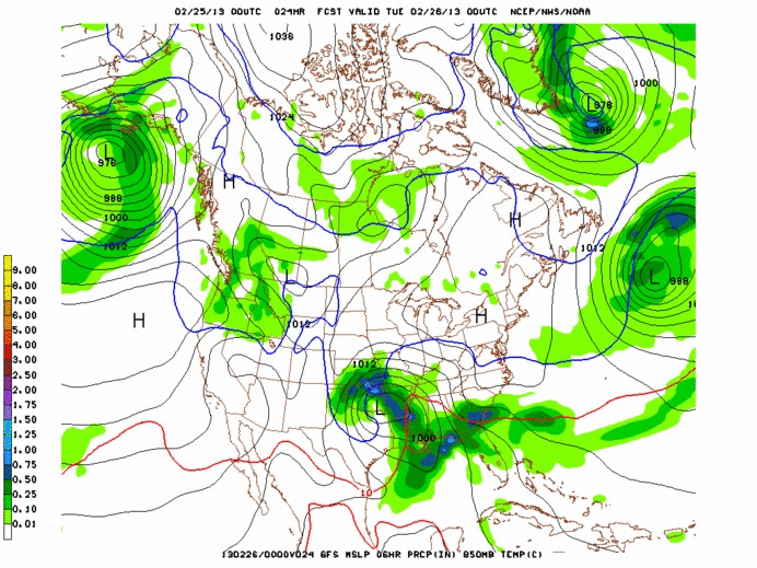
At about the same time (wednesday during the day) a weak area of low pressure will develop along the coast. In reality this will just create one large spread out low pressure “region.” The combined effect will be to draw some cooler air into the northeast, pushing most all elevations below the freezing level by late Wednesday.
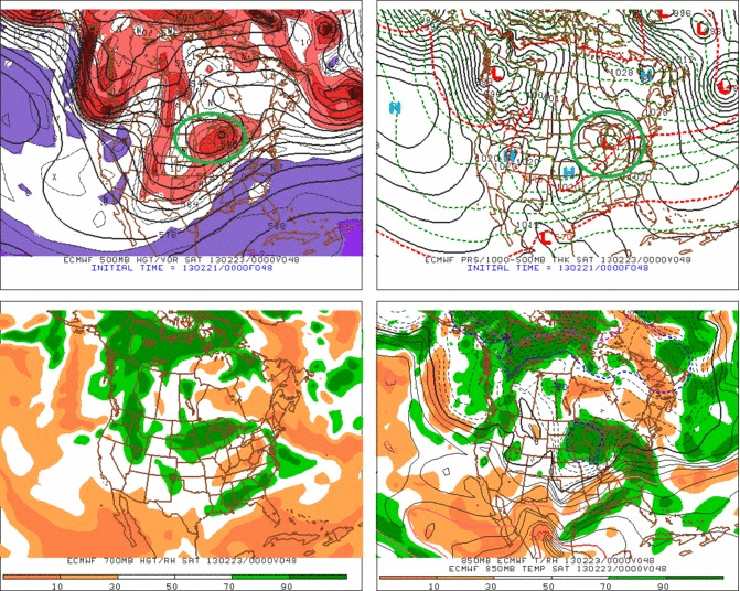
From Wednesday onwards through early Saturday, the large, vertically stacked, and cut off low will slowly drift eastwards. The EURO is the most progressive model and scoots the low out of the region late friday. It’s also the strongest so the faster pace makes sense. The GFS and NAM both linger the low into saturday morning.
Breaking this whole thing down here is what I can say.
– Snow breaks out wednesday across the N/E. Heaviest stuff is likely in the ADK. Some mixing will occur in VT and the ADK as warm air moves in at the mid levels of the atmosphere.
– Strong, moist southeast winds could spark some heavy upslope snow in/around Mt. Wash (yes, upslope on an east wind happens over there).
– By wednesday afternoon/evening everything should be back to all snow.
– The stable low will move through the region slowly from wednesday night to friday.
– Upslope dynamics don’t look insane right now but these events make pows. Simple as that.
– The ADK will see the best “synoptic snow” Wed into Thursday. As the low moves through NYS and So. VT and shifts the winds to the north, the upslope dynamics will favor VT.
– Overall, widespread 6-12 seems reasonable right now. I’m going to leave open the possibility to bump this up into the 12-20 range for parts of the Greens depending on how the upslope signal develops.
1 pm Tuesday Update
So, the storm is going to linger in such a location that instead of a prolonged NW wind upslope induced event, it should have a prolonged E/Southeast wind factor. That favors the White mountains, Southern VT and the Eastern Slopes of the Eastern ADK.
So I think my updated totals are as follows.
VT: Border to 89, 6-8ish, 89 south 6-12.
ADK: Eastern most slopes 8-14, more n/nw zones 6-10.
Whites: Feet are possible.
End Update
No Sun On Fogday
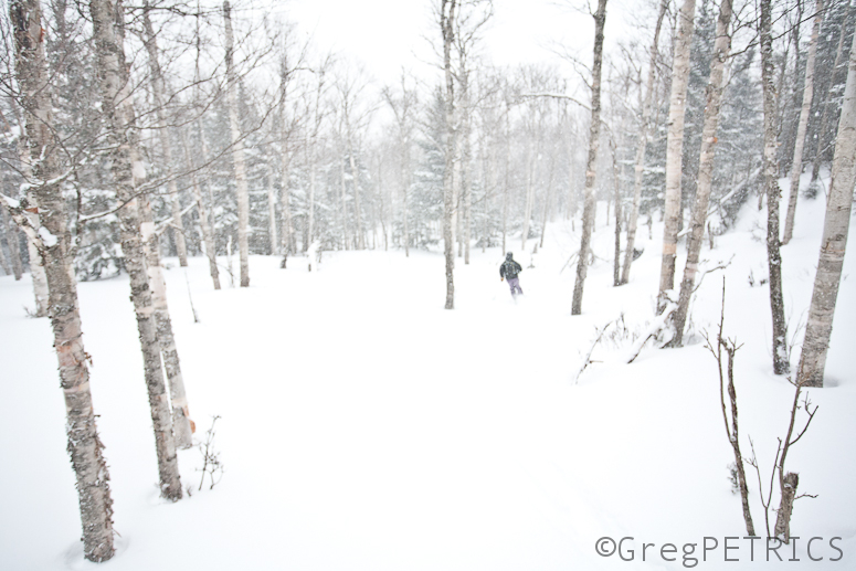
In the northeast there’s sometimes an 8th day of the week: Fogday. And yesterday was definitely Fogday.
This time of year, we’re past the crystal clear frozen days of January, and now that we’re in February, the storm track is more in our favor. But with that storm track, comes more moisture in the air. And with that moisture in the air, comes Fogday. And with Fogday, comes limited visibility.
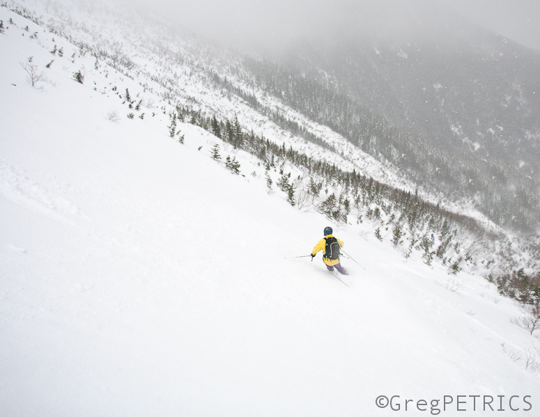
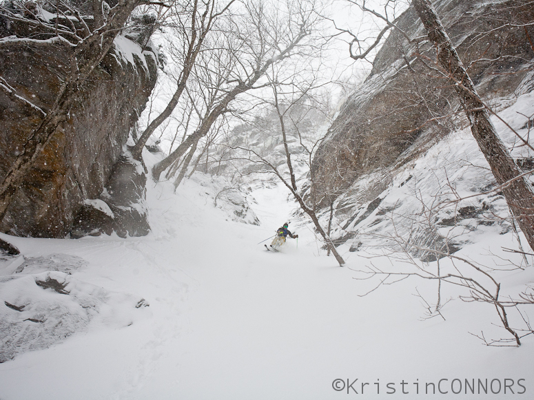
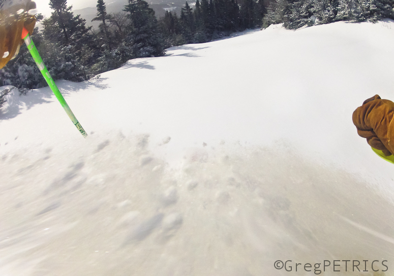
We did our best on Fogday to keep our bearings though. KC led the charge as usual.
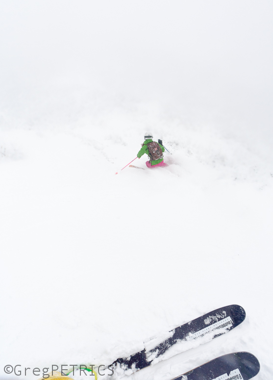
Which way is down?
“I think this way is down,” I said.
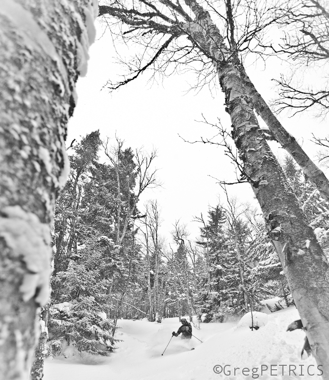
When we got down out of the alpine and into the forests, Lionel was able to use the massive birch trees as a guide for navigation.
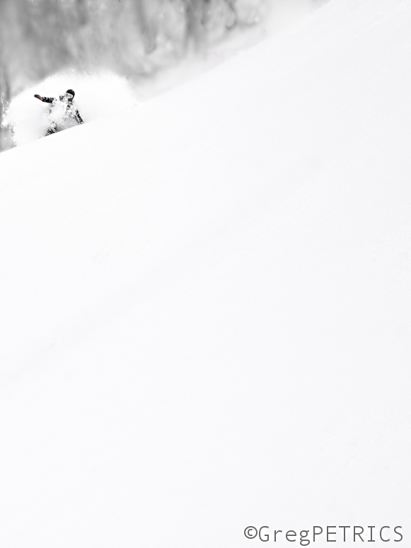
Fogday did funny things to my auto focus however. We’ll just call this one “art.”
And we’ll just call this one of KC “gnar.”
When the fog lifted for a bit, because it was Fogday, and it was only proper, I hid behinds some trees to limit my visibility anyway.
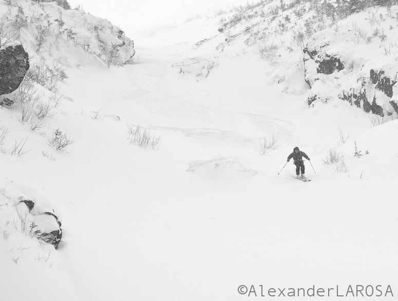
And when there were no trees to hide behind, we tried to get into some tight spaces in the spirit of Fogday.
I hope you found but didn’t see some schuss of your own on Fogday! I hear Tuesday might be sunny, and then after that, did someone say “snow?” Git sum!
Taco Night
“Why is this post about powder skiing called ‘Taco Night’?” you ask. Why do you hate taco night? No seriously. Who died and made you head of the Gestaco?!
Tacos are all about the extras. Extra cheese. Extra tomatoes. Extra salsa.
Which do you prefer? Soft tacos or hard?
Ever had a bad taco? I didn’t think so.
Go git sum tacos of your own. NOW! Let that taco overflow with deliciousness.
Next Up…More Pow? (updated with UT content and maybe next week pow)
Well, another midweek comes and goes, another midweek upslope pow event comes and goes. So what’s next right? Well how about some more snow? Would you all like that?
So, remember in Nemo when I talked about how two lows interacted with the final product being a super strong coastal low? Wait, no, you don’t? Whatever, I remember and take my word- it happened. Well a similar situation could unfold this weekend albeit with a weaker coastal low developing.
Lets take a look at a few model solutions to see what I’m talking about.
Below is the GFS. I’ve annotated the two low structure I’m talking about. You can see the “northern” low deepen in the center of the country and move towards the Great Lakes. At about the time it reaches Western NY, a low from the south is developing along a cold front assocaited with the northern low. (Orange cirlce). That low then moves up the coast, deepens, and draws energy away from the northern low. The coastal low reaches the NY bight late saturday/early sunday and takes a East/Northeast track over Cape Cod on Sunday and moves out into the Gulf of Maine.
The European Model is very similar. Makes a slightly stronger coastal low, and weakens the northern low, as comapred to the GFS but overall…it’s about the same.
Now, some of you have seen talk about these storms already. Not to be a dick, but any predictions at this point as to what kinda snow this event is going to make, and where it is going to make it. Especially, when such a prediction uses a “clown” map, is just silly. We’re a ways off from this event unfolding and so measured, analytic terms are appropriate.
For now, the models are spitting out pretty heavy totals for Northern VT.
Here is a sample for Jay Peak:
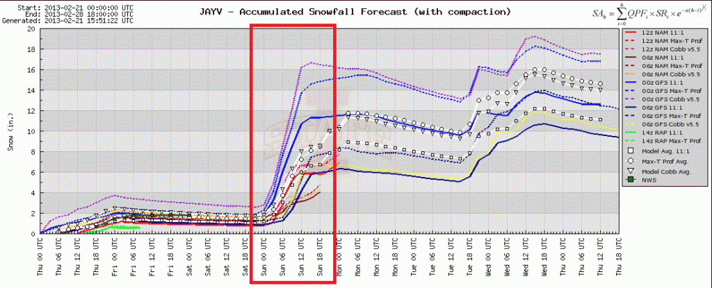
Looks awesome right?
Well I don’t believe it. I think (oh and as I type this the 12z model suite comes out supporting my point) that this storm is going track further s/e than previously modeled. So lets pull up a diagram to make this point. In the image below the red arrow is generally the modeled track.
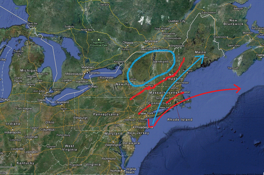
When mid-latitude cyclones move up the east coast of the U.S. the dynamics of the triple jet structure associate with them creates a pocket of heavy snow to the N/W of the low. Normally that area doesn’t extend much more than 50 or 100 miles to the N/W from the track. Beyond that, atmospheric dynamics favor a sharp cutoff of precip. So when a model throws off a ton of precip way northwest of a coastal low, I’m skeptical.
For real pow to impact the ADK and VT, I’d like to see at least a track matching the one outlined in blue. Now, that’s not saying we can’t get a good pow from the red track. In fact we can. More likely it will come as did the best pow in Nemo. From an interaction with the “northern” low’s warm front and moisture from the southern low. That’s tricky to forecast and right now I don’t see it. Nor do I see how, if the low tracks as modeled, (and accounting for today’s slight eastward trend) that we get a major dump out of this. I’m of course leaving my forecast open to adjustment. For now I’m going with something like 6-10 in the ADK and Nor. VT, Whites and N/W Maine. Possibly more in the Catskills, Berks (way more) and again, So. NH.
So I guess you’ll just have to deal with the 1-2 feet of new upslope snow…Life’s so hard.
UPDATE, FRIDAY AM (Pre-poo)
So first, an update on the weekend storm. We’re still in line with my basic thinking outlined above. Coastal low takes a fairly flat east/ne track. That’s going to put the heaviest snow band, Sat night thru Sunday, in the Catskills (mixing), Mass, and Southern NH. North in VT and the #ADK I think about 3-7 inches of snow will fall. Some models are showing an elevated tongue of moisture affecting the champlain valley. Not sure I believe a) that idea and b) that such moisture will not actually fall on the spine. So, lets say there is a chance (under 50% that some areas in the Central spine- Kmart thru Sugarbush) pick up 8-10 inches of snow.
Now we turn to Utah. On Saturday, a classic cold UT cold front will hit the Wasatch. With good moisture through the 700mb level, plenty of lift, and nice cold temps this has all the makings of a very good pow. Timing wise I think some light snow will move in Friday – late afternoon- with the heaviest snow coming saturday thru saturday night. The GSL is pretty warm, and the air incoming is fairly cold. So if the winds line up right, and it looks like they might late saturday, early sunday am, I think we might even get a little lake effect action. Over all I think this is a quick 10-20+ type storm for LCC/BCC and maybe 6-10 elsewhere.
Lastly, I’m VERY VERY interested in next week for the N/E. I like the idea of a cut-off stationary low parking over the N/E. It just makes sense. It’s happened several times before, particularly in years with an ENSO signature similar to this one. It also commonly happens this time of year. So I see NO reason why the consistent model solutions aren’t 100% viable. Will they play out. I dunno. But I’m watching it closely.
End Update
–Lionel.

-
Search
New Comments
Surfing Safari on Burlington's Booth Street | Seven Days said: “[…] lights and snapped away. Here’s a...(read more)” about Surfing the Flood
macbook repair seattle said: “macbook repair seattle Let’s get it started...(read more)” about Let’s get it started
Greg said: “Thanks for all this great info. And...(read more)” about Skiing Mt. Colden’s Trap Dike
Greg said: “Definitely late, but always welcome!” about Skiing Mt. Colden’s Trap Dike
Bob said: “[* Shield Security plugin marked this comment...(read more)” about Skiing Mt. Colden’s Trap Dike
Regular paint Maintenance said: “Regular paint Maintenance Behind The Schuss(ic) :...(read more)” about Behind The Schuss(ic)
The 2012-13 Ski Season in Photos #13 | NY Ski Blog said: “[…] tweeting about big Memorial Day snow...(read more)” about pow
ml242 said: “LuckyLuc and MadPat on the same day?...(read more)” about Deep Cover Anthropology
Twitter Feed
-
Categories
- Skiing (438)
- Weather (188)
- WTF (5)
- Quick Update (173)
- Full Trip Report (165)
- WebiGNARs (45)
- General Interest (38)
- Site News (27)
- Summer (59)
- Hiking (26)
- Swimming (15)
- Climbing (13)
- Longboarding (3)
- Whitewater Kayaking (2)
- Mountain Biking (1)
- SPA (16)
- Gear Review (8)
-
Archive
- October 2018
- June 2017
- November 2016
- October 2016
- March 2016
- January 2016
- October 2015
- February 2015
- January 2015
- December 2014
- November 2014
- October 2014
- September 2014
- July 2014
- April 2014
- March 2014
- February 2014
- January 2014
- December 2013
- November 2013
- October 2013
- September 2013
- August 2013
- June 2013
- May 2013
- April 2013
- March 2013
- February 2013
- January 2013
- December 2012
- November 2012
- October 2012
- September 2012
- August 2012
- July 2012
- June 2012
- May 2012
- April 2012
- March 2012
- February 2012
- January 2012
- December 2011
- November 2011
- October 2011
- September 2011
- August 2011
- July 2011
- June 2011
- May 2011
- April 2011
- March 2011
- February 2011
- January 2011
- December 2010
- November 2010
- October 2010
- September 2010
- August 2010
- July 2010
- June 2010
- May 2010
- April 2010
- March 2010
- February 2010
- January 2010
- December 2009
- November 2009
- October 2009
- September 2009
- August 2009
- July 2009
- June 2009
- April 2009
- March 2009
- February 2009
- January 2009
- December 2008
- November 2008
- October 2008
- April 2008
- March 2008
- February 2008
-
Friends of F.I.S.

About Us:
We are a group of powder hungry, east-coast-bred, world-traveling skiers and riders who Earn Our Turns to bring you the best stoke a click-of-the-mouse can buy.We hope our adventures inspire you to Earn Your Turns as well!
LEARN MORE

Latest Weather
When one makes meatballs, one must begin with quality meats: ...
Read more in: Meatballs! (read more)